Categories
Blog

How Much Does Land Grading Cost?

How Much Does Land Grading Cost?

How Much Does Land Grading Cost?

How Much Does Land Grading Cost in 2026? (Quick Answer)

Land grading cost typically falls between $0.08 and $2.00 per square foot. Most homeowners pay $770 to $3,000 for a standard residential project covering 1,000 to 2,000 square feet.

Here’s a fast reference to help you estimate your project:

  • Per square foot (national average): $0.08 – $2.00
  • Typical residential project (1,000-2,000 sq ft): $770 – $3,000
  • Quarter-acre lot: $3,950 – $11,134
  • Per acre: $15,800 – $44,535
  • Hourly rate (labor + equipment): $40 – $180/hr
  • Grading permit: $150 – $485

These numbers shift based on your soil, slope, location, and what work is actually needed. The sections below break it all down clearly.

Standing water in your yard after rain. A foundation that slopes the wrong way. A new patio that won’t drain. These are the moments when homeowners start asking what it actually costs to fix the ground beneath their feet.

Land grading is one of those projects that seems straightforward until you start getting quotes. Prices vary widely — and without knowing what drives those numbers, it’s easy to overpay or underprepare.

This guide walks you through everything: average costs, what pushes prices up or down, regional differences, and how to get a quote you can actually trust.

I’m Don Larsen, CEO of Saga Infrastructure, a national platform that acquires and supports high-performing regional civil and site work contractors. My background spans construction, operations, and business development across complex multi-site organizations — and land grading cost is a topic I’ve seen play out on job sites and in budgets across the country. Whether you’re a homeowner planning a drainage fix or a builder prepping a new site, the numbers in this guide reflect real-world pricing from the ground up.
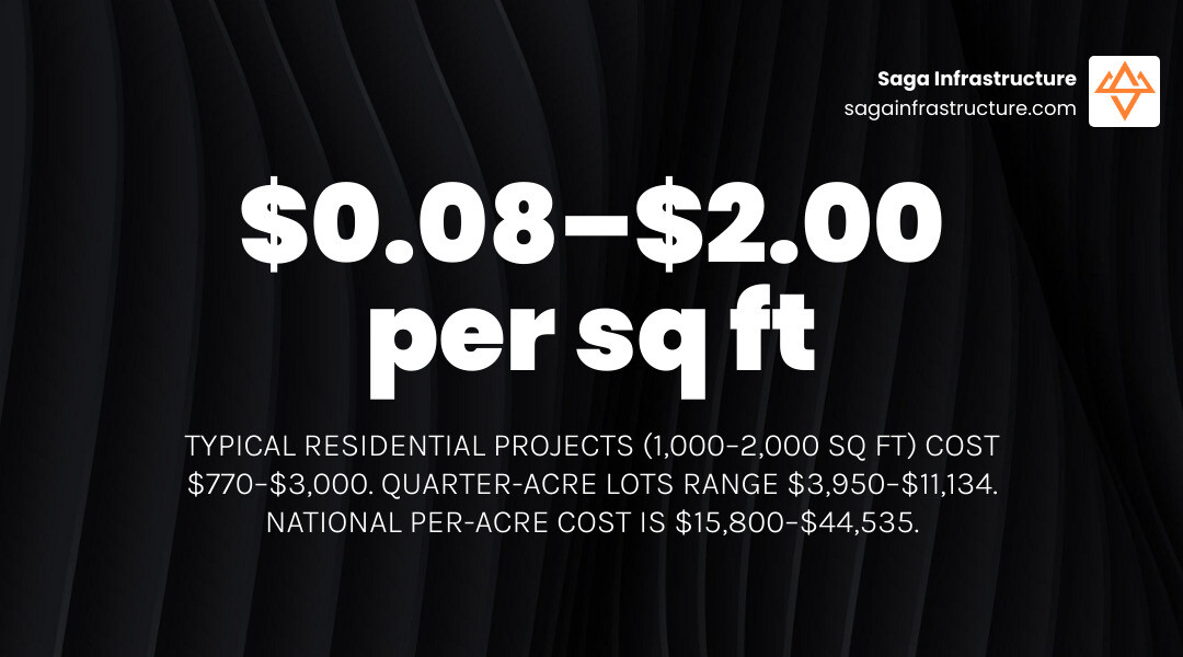
Average land grading costs by square foot, acre, and project type infographic infographic

Important land grading cost terms:

What Land Grading Is and Why Homeowners Pay for It

Land grading means reshaping the ground so water drains the right way and the site works the way it should. Sometimes that means cutting high spots down. Sometimes it means filling low spots in. Sometimes it means both, which is the dirt version of moving furniture around until the room finally makes sense.

For homeowners, grading is usually about one or more of these goals:

  • Moving water away from the house
  • Protecting the foundation
  • Fixing soggy or muddy areas
  • Preparing for a patio, driveway, or addition
  • Creating a smoother, safer yard
  • Reducing erosion

before and after yard grading

What land grading means for a home site

On a residential property, grading often includes:

  • Correcting negative slope toward the home
  • Creating a gentle fall away from the foundation
  • Building up or leveling a pad for a shed, driveway, or structure
  • Balancing cut and fill so less dirt has to be hauled in or out
  • Smoothing the site for final landscaping

If you have standing water that sticks around more than a day after rain, ruts that keep getting worse, or soil washing away, grading may be the fix. It is also common before new construction, because builders need a stable building pad and a site that drains well from day one.

Why grading is necessary around homes

Bad grading can lead to expensive problems fast. Water that runs toward the house can cause basement leaks, crawlspace moisture, slab issues, and foundation movement. Even if your home is fine structurally, poor grading can make the yard hard to mow, impossible to landscape, and messy every time it rains.

We often tell homeowners to think of grading as prevention, not just repair. Spending money now on shaping the land can help avoid much bigger costs later.

For a deeper overview, see The Straight Dirt on Land Grading and Leveling.

Rough grading vs final grading vs grading with drainage

These terms matter because they affect the final price.

  • Rough grading: Big reshaping work. This is the heavy earthmoving stage that establishes major slopes and elevations.
  • Final grading: Fine-tuning the surface. This usually includes smoothing, preparing for seed or sod, and getting the finished elevation right.
  • Grading with drainage: Adds water-management features like swales, catch basins, trenching, or French drains.

Rough grading is often more machine-heavy. Final grading needs more precision. Grading with drainage takes more planning and more materials.

If drainage is the real problem, grading alone may not solve it. In many cases, the smart fix is a grading-and-drainage package. You can learn more in The Essential Guide to Grading and Drainage Systems.

Average Land Grading Cost in 2026

The average land grading cost depends on whether you are pricing by square foot, acre, or project type.

  • Per square foot: $0.08 – $2.00. Broad national range.
  • National average unit cost: $1.13 – $1.52. Common estimate for landscaping grading.
  • Typical residential project: $770 – $3,000. Usually 1,000-2,000 sq ft.
  • Per acre: $15,800 – $44,535. Large range based on site conditions.
  • National average per acre: About $30,000. Large-scale average.
  • Hourly labor + equipment: $40 – $180/hr. Depends on crew and machine type.

Land grading cost per square foot

Per-square-foot pricing is most useful for smaller residential jobs.

Research shows a broad range of $0.08 to $2.00 per square foot. That low end usually applies to light finish work on easy ground. The high end usually reflects heavier grading, difficult access, or added drainage work.

A separate 2026 unit-cost estimate puts landscaping grading at about $1.13 to $1.52 per square foot on average. That is a helpful middle range for planning, but not every project fits neatly inside it.

In plain English:

  • Fine grading usually costs less
  • Rough grading usually costs more
  • Tiny jobs can look expensive per square foot because mobilization still costs money

Land grading cost per acre

Per-acre pricing matters more for larger lots and rural properties. Nationally, grading an acre runs about $15,800 to $44,535, with an average around $30,000.

That does not mean every acre costs the same. A flat acre with easy access and good soil is very different from an acre with steep slopes, thick vegetation, drainage problems, or imported fill.

As projects get larger, the cost per square foot may drop because fixed costs like mobilization get spread out over more area. But if the site is complex, that savings can disappear quickly.

Typical residential project costs by yard size

Most homeowners are not grading a whole acre. They are fixing a section of yard, a drainage path, or the area around a home.

Here are useful ballpark ranges:

  • 500 sq ft: about $400 to $1,000
  • 1,000 to 2,000 sq ft: about $770 to $3,000
  • 5,000 sq ft: about $3,500 to $9,000
  • 10,000 sq ft: about $5,000 to $15,000
  • Quarter-acre lot: about $3,950 to $11,134
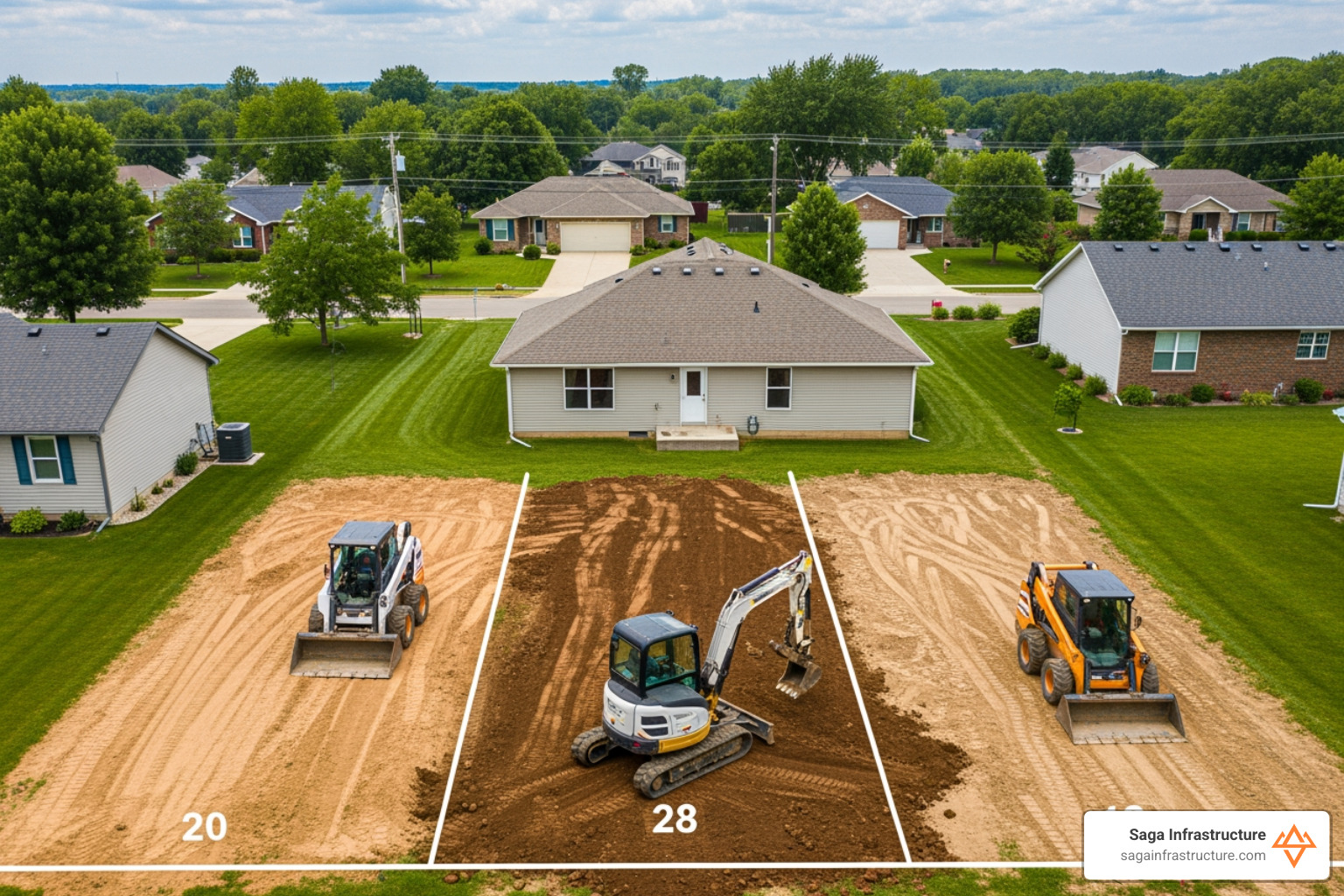
grading cost chart for common lot sizes

The quarter-acre range surprises a lot of people. That is because quarter-acre jobs often involve more than simple smoothing. Drainage correction, hauling, topsoil replacement, and tight access around an existing house all add cost.

Hourly equipment and labor costs that shape the bill

Some contractors price grading as a project lump sum, but the math behind the quote still comes back to labor and equipment hours.

Typical hourly rates range from $40 to $180 per hour, depending on:

  • Operator skill
  • Machine type
  • Number of crew members
  • Project complexity
  • Local labor market

Common equipment includes:

  • Skid steers
  • Mini excavators
  • Bulldozers
  • Backhoes
  • Compactors

Equipment can account for 30% to 40% of the total project cost. If your yard needs a compact machine because access is tight, the job may take longer. If it needs a larger dozer or excavator, hourly cost may jump.

What Makes Land Grading Cost Go Up or Down

Size, slope, and terrain complexity

The biggest price driver is how much earth has to move and how hard it is to move it.

A flat lot with a small drainage issue is usually straightforward. A steep lot, hillside, or heavily uneven site is not. More slope means:

  • More cuts and fills
  • More machine time
  • More chance of erosion control
  • Possible need for terracing or walls

The ideal project balances cut and fill so soil can be reused on site. If a job needs lots of imported fill or lots of hauled-off spoil, cost climbs.

Soil conditions and material movement

Soil type matters more than most homeowners expect.

  • Sandy soil is often easier to shape
  • Clay soil can be sticky, dense, and slow to work with
  • Rocky soil raises labor and wear on equipment
  • Organic or unstable soils may need removal and replacement
  • Hard rock conditions can require specialized equipment

For Florida properties, soil and drainage conditions can swing costs sharply. Basic rough grading there often runs about $1,500 to $5,000 per acre. Final grading is commonly $3,000 to $8,000 per acre. Grading with drainage can reach $4,000 to $10,000+ per acre.

Fill dirt is another major line item. Research shows fill material often costs $15 to $50 per cubic yard. If topsoil gets stripped during grading, it may need to be replaced later before seeding or sod.

Access, equipment, and jobsite obstacles

A simple site can become a difficult one if machines cannot reach it easily.

Common cost boosters include:

  • Narrow gates
  • Fences
  • Existing patios or driveways
  • Trees and stumps
  • Utility lines
  • Septic systems
  • Wet ground conditions

Tight access may require smaller equipment and more manual work. Wooded sites may need clearing before grading can start. If debris, roots, or old concrete must be hauled away, disposal charges get added too.

Before any digging starts, call 811 so underground utilities can be marked. That step is free. Hitting a utility line is very much not free.

Permits, surveys, engineering, and compaction testing

Not every yard grading job needs permits or engineering, but some do.

Common planning costs include:

  • Grading permit: about $150 to $485
  • Land survey: about $500 to $1,200
  • Engineering or drainage plans: varies widely
  • Compaction testing: about $200 to $500 per test

A commonly cited threshold is that permits may be required when disturbing more than 5,000 square feet of land, though local rules vary. In Florida, permits and engineering costs can be much higher on projects involving stormwater, flood zones, or larger site work.

If your project includes a building pad, driveway base, or structural support area, compaction matters. Loose soil under a finished surface is a future problem in disguise.

For more background, see Everything You Need to Know About Heavy Earthmoving and Site Development.

Extra Costs Homeowners Often Miss

Drainage fixes that should be priced with grading

A grading quote may not include drainage unless you ask.

That matters because many grading projects exist for one reason: water. If the water issue is not addressed, you may pay for a smooth yard that still acts like a swamp after every storm.

Common drainage add-ons include:

  • French drains: about $10 to $75 per linear foot
  • Swales
  • Catch basins
  • Trench drains
  • Downspout tie-ins

In our view, drainage should be discussed early, not treated like a surprise side quest halfway through the job.

Fill dirt, topsoil, and finish materials

Quotes often separate earthmoving from finish materials.

Watch for line items like:

  • Fill dirt: $15 to $50 per cubic yard
  • Topsoil replacement
  • Seed
  • Mulch
  • Sod: about $1 to $2 per square foot

Topsoil is especially important around homes. Rough grading may establish the shape, but the final growing surface still needs the right material if you want grass to come back instead of mud.

Erosion control, retaining walls, and cleanup

If your site has slope or loose soil, erosion control may be necessary after grading.

Possible extra costs include:

  • Silt fence
  • Erosion blankets
  • Straw or mulch cover
  • Washout prevention
  • Reseeding
  • Final cleanup

Retaining walls can also enter the picture when a slope is too steep to grade safely on its own. Those are separate structures and can add thousands to the total project budget.

New construction and driveway prep add-ons

Grading for new construction is different from simple yard leveling. Add-ons may include:

  • Building pad prep
  • Foundation grading
  • Driveway base prep
  • Clearing and stripping vegetation
  • Compaction work
  • Gravel installation

If your project is tied to a home build, garage, or driveway, related site work may cost more than the grading itself.

For related reading, see The Groundwork Essentials for Your New Construction Project and From Dirt to Driveway: Mastering Grading and Paving.

Regional Land Grading Cost Differences

Where your property sits has a real effect on land grading cost. Since we serve Florida, Texas, and Arizona markets, those are the locations that matter most for planning.

West Georgia and wider Georgia pricing

Georgia pricing appears in some industry guides, but since our focus here is on the areas we serve, we use it only as broad context rather than as a target estimate for your project. If you are outside our active service areas, local conditions and codes can shift the numbers fast.

Florida pricing by region and drainage demand

Florida is one of the clearest examples of why local conditions matter.

Statewide guide data shows:

  • Basic rough grading: about $1,500 to $5,000 per acre
  • Final grading: about $3,000 to $8,000 per acre
  • Grading with drainage: about $4,000 to $10,000+ per acre

Those ranges reflect several Florida realities:

  • High water tables
  • Flat sites that still need precise drainage
  • Stormwater rules
  • Flood-zone requirements in some areas
  • Soft or organic soils in certain locations

For homeowners in Minneola, Clermont, and nearby Central Florida areas, drainage often drives the project more than slope does. A yard can look almost flat and still need careful grading to keep water away from the house. See Land Grading | Minneola, FL | South Lake Loader Service and Grading in Clermont, FL – Costs 02 / 2026 – Homeyou for local market examples.

California and Colorado examples

Some national articles compare pricing in places like California and Colorado. Those can be useful for understanding how hillside terrain, access, and regional labor rates affect cost in general, but they are not a strong budgeting tool for Florida, Texas, or Arizona jobs.

If you want to see how local quote guides present those differences, you can review Local grading cost examples in California and Regional grading pricing in Colorado. Just do not treat them as local pricing for our service areas.

How to use local guides without trusting averages too much

Online averages are best for rough planning, not final budgeting.

Use them to build a budget range, then get a site-specific quote based on:

  • Zip code
  • Square footage or acreage
  • Drainage needs
  • Soil conditions
  • Access limits
  • Imported or exported dirt
  • Finish grade expectations

That is how you avoid comparing your real project to someone else’s simple flat-lot example.

DIY vs Professional Grading and How to Get Accurate Quotes

When DIY grading makes sense

DIY grading can make sense for very small, simple jobs, such as:

  • Leveling a tiny area for a playset
  • Touching up around a garden bed
  • Smoothing a patio base by hand
  • Fixing a minor low spot in the yard

For jobs like that, hand tools or a small rental machine may be enough.

When professional grading is worth the investment

Professional grading is usually worth it when the project affects:

  • Foundation drainage
  • Large yard slopes
  • Retaining walls
  • Permit-required earthmoving
  • Driveway or building pad prep
  • Persistent standing water
  • Large amounts of cut and fill

Mistakes in grading are expensive because they do not always show up right away. Sometimes the bill arrives with the next hard rain.

How to get accurate grading quotes

Get 3 to 5 quotes and ask each contractor for the same scope. Request itemized details that cover:

  • Total area to be graded
  • Rough grading or final grading
  • Drainage features included or excluded
  • Fill dirt or topsoil quantities
  • Haul-off and disposal
  • Permit responsibility
  • Timeline
  • Cleanup and restoration
  • Insurance and licensing

Questions to ask a grading contractor:

  • Is drainage correction included in this quote?
  • Are fill dirt and topsoil separate line items?
  • Will you reuse soil on site when possible?
  • What happens if unsuitable soil is found?
  • Do you handle permits and inspections?
  • What equipment will be used?
  • How will you protect the home, driveway, and utilities?
  • Is erosion control included?
  • What finish should we expect when the job is done?

For more cost examples, see Cost to Grade Landscaping – 2026 Cost Calculator (Customizable), How Much Does Land Grading Cost in 2026? – Lawn Love, and Cost for Grading Yard: cost for grading yard pricing and tips in 2026 | TruTec Blog.

Smart ways to save money without creating drainage problems

You can save money on grading without cutting the wrong corners.

Good ways to reduce cost:

  • Bundle grading with drainage or driveway work
  • Remove debris before the crew arrives
  • Reuse on-site soil when possible
  • Keep the scope clear and simple
  • Schedule during slower periods if available
  • Get multiple quotes based on the same plan

Bad ways to save money:

  • Skipping drainage when water is the issue
  • Choosing the cheapest quote with vague scope
  • Ignoring permits
  • Assuming topsoil is included
  • DIY-ing a foundation drainage fix with optimism and a shovel

Frequently Asked Questions About Land Grading Cost

How much does land grading cost for a quarter-acre lot?

A quarter-acre lot typically costs about $3,950 to $11,134 to grade. The final number depends on slope, access, fill needs, drainage work, and whether material has to be hauled in or out.

Does land grading cost include topsoil and drainage?

Usually not automatically. Many quotes separate grading, fill dirt, topsoil, seed, sod, and drainage features into different line items. Always ask what is included.

How long does a grading project usually take?

A small simple project may take 1 to 2 days. More complex residential work often takes several days. Larger or drainage-heavy projects can take a week or more, especially if weather, inspections, or material delivery affect the schedule.

Conclusion

The best way to estimate land grading cost is to start with the common ranges, then narrow them down with a real site visit. For many homeowners, that means budgeting anywhere from a few hundred dollars for a tiny touch-up to several thousand for a drainage-focused yard project, and much more for large lots or acre-scale work.

The key is understanding what you are paying for: not just moving dirt, but shaping the site so it drains, supports structures, and stays stable over time.

At Saga Infrastructure, we believe good site work is part of protecting what people build. We bring the practical mindset of local contractors together with the resources of a broader platform, especially in the Florida, Texas, and Arizona markets we know best.

If you are planning site work and want to better understand the contractor side of growth and infrastructure, visit More info about business owners.

Categories
Blog

How Much Does Site Prep Really Cost

How Much Does Site Prep Really Cost

How Much Does Site Prep Really Cost

What Does Site Prep Really Cost Per Square Foot?

Preparing your land for building usually costs $1.50 to $5.00 per square foot. Most people pay about $3.80 per square foot in 2026. Here is a quick look at the costs:

  • Flat, clean lot with utilities nearby: $1.50 to $2.50 per sq. ft., or about $10,000 to $20,000 total.
  • Normal yard: $2.50 to $4.00 per sq. ft., or about $15,000 to $35,000 total.
  • Sloped lot with lots of trees and no utilities: $4.00 to $7.00+ per sq. ft., or about $40,000 to $70,000+ total.
  • Rocky or very hard land: $5.00 to $10.00+ per sq. ft., or about $50,000+ total.

These prices can change fast. It depends on your soil, trees, and how close you are to power and water.

Many people get surprised by the cost. Builders often do not include site prep in their first price. Removing trees, blasting rocks, and putting in pipes cost extra. One homeowner skipped a $1,500 soil test. Later, they had to spend $18,000 to fix their foundation because the clay soil was bad. That is a huge surprise!

Knowing these costs before you start helps you save money.

My name is Don Larsen. I am the boss at Saga Infrastructure. I have spent my career working on big building projects. I know how to keep site prep costs low. In this guide, I will help you understand these costs so you can plan your project.

Site prep cost per square foot breakdown infographic by lot type and component infographic

Quick links to help you:

Average Site Prep Cost per Square Foot in 2026

When you build a new house, you need to plan your budget. In 2026, preparing a basic yard costs about $3,800. But a full home site usually costs between $15,000 and $35,000. If the land is wild and has no roads or power, it can cost $50,000 to $70,000 or more.

The cost per square foot goes down when the project is bigger. This is because moving big machines to the site costs the same whether the land is small or large.

According to How Much Does Site Preparation Cost? [2026 Data] | Angi, here are the average costs for 2026:

  • Small pad, 1,000 sq. ft.:
    • Easy flat, cleared lot: $1.50 to $2.00 per sq. ft.
    • Moderate lot with some trees or slope: $2.50 to $4.00 per sq. ft.
    • Difficult lot with heavy woods, rock, or slope: $5.00 to $10.00+ per sq. ft.
  • Typical home site, 2,500 sq. ft.:
    • Easy flat, cleared lot: $1.50 to $2.50 per sq. ft.
    • Moderate lot with some trees or slope: $3.00 to $5.00 per sq. ft.
    • Difficult lot with heavy woods, rock, or slope: $6.00 to $12.00+ per sq. ft.
  • Large lot, 1 acre or 43,560 sq. ft.:
    • Easy flat, cleared lot: $0.11 to $0.25 per sq. ft.
    • Moderate lot with some trees or slope: $0.25 to $0.50 per sq. ft.
    • Difficult lot with heavy woods, rock, or slope: $0.60 to $1.50+ per sq. ft.
  • Acreage, 5+ acres:
    • Easy flat, cleared lot: $0.05 to $0.15 per sq. ft.
    • Moderate lot with some trees or slope: $0.15 to $0.35 per sq. ft.
    • Difficult lot with heavy woods, rock, or slope: $0.40 to $1.00+ per sq. ft.

Preparing a small yard might cost more per square foot than a huge field. But the total cost for a big field is still much higher because there is so much more land to clear.

Key Components of Site Preparation and Their Costs

Site prep is not just one job. It is a list of steps to make wild land ready for a building. If you skip a step, your building could crack or sink later.

To see where your money goes, you can read The Groundwork Essentials for Your New Construction Project. The work usually goes in this order:

  1. Clearing the Land: Taking away trees, bushes, and roots.
  2. Digging and Moving Dirt: Shifting dirt to make the ground flat.
  3. Grading: Making the ground slope slightly so water flows away from the building.
  4. Packing the Soil: Pressing the dirt down hard so it can hold a heavy building.

Let us look at each step and what it costs.

Land Clearing and Tree Removal Costs

Before tractors can flatten the ground, we must clear the plants. Clearing land usually costs $5,000 to $11,000 per acre. That is about $0.11 to $0.25 per square foot.

If there are many trees, it costs more. According to How Much Does Site Prep Cost Before Building a House? (2026 Breakdown) – BuildWithEmil, removing trees for a normal home costs $1,500 to $6,000.

You also have to pull out the tree stumps and roots. This is called “grubbing.” If you leave roots in the dirt, they will rot. This leaves empty holes under the ground. Then, the ground sinks and cracks your house. Grubbing can cost $5,000 to $15,000, but it is very important.

Excavation, Grading, and Compaction Site Prep Cost per Square Foot

After clearing, we move the dirt. We want the ground flat where the house goes, and sloped elsewhere so rain runs away.

You can learn more about this in The Straight Dirt on Land Grading and Leveling. Here are the costs:

  • Digging (Excavation): Costs $0.50 to $2.00 per square foot. This is for digging the hole for the foundation.
  • Leveling (Grading): Costs about $0.06 to $0.11 per square foot.
  • Packing (Compaction): Costs $0.20 to $0.50 per square foot.

Workers use big machines to scoop dirt from high spots and dump it in low spots. Then, they roll heavy machines over the dirt to pack it tight. This keeps the house from shifting.

Concrete Slab Site Prep Cost per Square Foot

If you are building on a flat concrete floor, the prep work must be very neat. You cannot just pour concrete on loose dirt.

According to Concrete Slab Site Prep Cost 2026: $1 to $5 Per Square Foot | concreteslabcost.com, preparing the ground for a concrete floor costs $1.00 to $5.00 per square foot. This work includes:

  • Digging the Hole: Digging down 6 to 12 inches.
  • Adding Gravel: Putting down 4 to 6 inches of crushed stone. This costs $0.50 to $1.50 per square foot. It stops water from rising into the concrete.
  • Plastic Barrier: Laying down thick plastic sheeting. This costs $0.10 to $0.40 per square foot. It keeps the floor dry and stops mold.
  • Final Packing: Making sure the gravel and dirt are locked tight.

Skipping these steps to save money is a bad idea. Fixing a cracked floor later can cost ten times more than doing it right the first time.

Environmental, Utility, and Lot Condition Cost Drivers

Now let us talk about other things that can change your costs.

utility trenching for site preparation on residential lot

These factors are hard to see at first, but they can make your site prep cost much more.

Soil Testing, Erosion Control, and Drainage Systems

Before big trucks start, you must test the soil. A soil test costs $500 to $2,500. It tells you if your soil is sandy, rocky, or full of sticky clay.

When it rains, you must stop mud from washing away. Special fences and gravel paths help keep the dirt on your lot. These cost $1,000 to $4,000. You can read more in our Step-by-Step Guide to Erosion Control Solutions.

You might also need pipes to carry water away. These are called French drains. They cost $4 to $10 per foot. They protect your house from water damage.

Utility Connections and Site Access

If your land is wild, you need to bring in power, water, and sewer. This costs $20 to $120 per foot.

If the pipes are close to your house, it might cost $10,000 to $25,000. But if your house is far from the road, it can cost $30,000 to $50,000 or more.

You also need a road for heavy trucks to drive on. A temporary gravel road costs $2,000 to $12,000. Read more about this in our guide: Ready Set Build: A Complete Checklist for Commercial Site Preparation.

Flat and Cleared vs. Sloped and Wooded Lots

The shape of your land matters a lot.

sloped rocky terrain site preparation and grading work

A flat, clean lot with power nearby is the best. Preparing this land is easy and costs $10,000 to $20,000.

But a steep, woody lot is much harder. You have to cut down trees and move lots of dirt. You might also need to build strong walls to hold back the dirt. These walls cost $20 to $50 per square foot.

Steep hills also change how you build your house. You might need a basement instead of a flat concrete floor. This costs more money. To see why these choices matter, read Why Site Prep for House Construction Is Your Most Important Step.

Regional Cost Variations Across the US

Where you build changes the price. Labor and materials cost different amounts in different states. Saga Infrastructure works in several fast-growing states. Here is how the location affects costs:

  • Florida (Minneola, Clermont): Florida has sandy soil. It is very easy to dig. But Florida is flat and wet. You must spend more money to keep water away from your house.
  • Texas: Texas has clay soil. Clay swells up when wet and shrinks when dry. This can crack a house. You need special soil tests and strong foundations here.
  • Arizona: Arizona is dry, but the ground is very rocky. Digging through hard rock requires special, expensive tools.

According to US Construction Costs by State: 2026 Guide & Pricing – 247Pro, knowing your local soil helps you avoid big surprises.

Frequently Asked Questions About Site Prep Costs

Here are answers to common questions about preparing your land.

How much extra money should I save for surprises?

You should save 15% to 20% extra money just for site prep.

When you dig underground, you never know what you will find. Workers might find buried trash, old pipes, water, or huge rocks. Having extra money ready means your project will not have to stop.

Does the builder’s price include site prep?

Usually, no. This is a mistake many people make.

Most builders will flatten the dirt at the very end. But they do not pay to clear trees, blast rocks, or bring in power lines. Always read your contract carefully. Ask your builder what is included and what you have to pay for yourself.

How long does site prep take?

For a normal, flat lot, site prep takes 1 to 3 weeks.

If you have lots of trees, rocks, or need long pipes, it can take 4 to 6 weeks. Bad weather can also slow things down. Heavy rain turns dirt into mud, and you cannot work on muddy ground.

Conclusion

At Saga Infrastructure, we know that a good building needs a strong start. We partner with great local construction companies, like Foshee Construction in Minneola, Florida. We give them the money and tools they need to grow, while keeping the local names and teams you already trust.

Whether you are building a house, a store, or putting in utility pipes, knowing your site prep cost per square foot is the first step. Working with local experts who know your soil and weather will help you start on solid ground.

Do you own a construction business and want to plan for the future? Or are you starting a big building project and need a partner you can trust?

Let us talk. Visit us at Saga Infrastructure today to see how we can build the future together.

Categories
Blog

The Ultimate Blueprint for Selling Your Construction Firm

The Ultimate Blueprint for Selling Your Construction Firm

The Ultimate Blueprint for Selling Your Construction Firm

What You Need to Know Before Selling a Construction Company

Selling a construction company is a very big choice. It is also a hard process.

Here are the main steps:

  1. Find the value of your business.
  2. Get your money records ready. You need 3 years of clean books.
  3. Make sure the business can run without you.
  4. Find the right buyer.
  5. Keep the sale a secret for now.
  6. Talk about the price and terms.
  7. Let the buyer check your business. This takes 45 to 90 days.
  8. Sign the legal papers.
  9. Help the new owner for a short time.

This usually takes 6 to 12 months.

Buyers look at your future work and your team. They want to know if the business stays strong when you leave. If you have clean records, you can get 20% to 30% more money. It is best to start planning 2 to 5 years before you want to sell.

I am Don Larsen, CEO of Saga Infrastructure. I have built and sold many construction businesses. I know how to help you do it right.

9-step process infographic for selling a construction company with timeline and key milestones - selling a construction

Helpful links:

Determining the Value When selling a construction company

How much is your company worth? In construction, we look at the profit your tools and team make.

Most people use a math tool called EBITDA. This shows the real cash your firm makes. Right now, big firms sell for 9-11 times their profit. Smaller firms might sell for 3 to 6 times their profit.

How to Value What it Looks At Who it is For
Profit Method Future money Growing firms
Asset Method Value of trucks and tools Firms with many machines
Market Method Sales of similar firms Local businesses
Owner Benefit Total money for the owner Very small firms

Buyers also look at your backlog. This is the work you have already signed up to do. If you have a lot of work for next year, your company is worth more. You can learn more about how to Sell Your Construction Business by seeing what buyers want.

Preparing Your Firm for a Successful Exit

You should get your business ready 3 to 5 years before you sell.

First, fix your money records. If your books are messy, the sale might fail. You need three years of clear records. This shows the buyer that your profit is real. Clean books can help you sell for much more money.

A clean, organized office desk representing a business ready for sale - selling a construction company

Next, make sure the business can run without you. If you do all the work, the business is hard to sell. You need a team that can lead. To Maximize Your Exit A Guide To Selling Your Construction Company, you must teach your managers how to run things.

Other steps:

  • Write down your rules: Make a book on how to do every job.
  • Fix your tools: Keep your trucks and machines in good shape.
  • Find more customers: Do not rely on just one big client.

Finding the Right Buyer for Your Business

Not all buyers are the same. The best buyer is the one who will take care of your team and your legacy.

At Saga Infrastructure, we want to protect what you built. We help local companies grow with more resources.

Two people shaking hands over a successful business deal - selling a construction company

There are three main types of buyers:

Strategic Partners

These are other construction firms. They want your team or your location. They might pay more, but they might change your company name.

Financial Buyers

These are groups with a lot of money. They want to help the business grow and then sell it again later. They bring in new systems to help.

Your Own Team

You can also sell to your managers. This keeps things the same for your workers. To learn more, read this Sell My Construction Business: 9-Step Guide To Protect Value And Exit Cleanly.

Selling a construction company has special rules. You need a team of helpers. This includes a broker, a money expert, and a lawyer.

You must think about insurance and bonds. You need to make sure the new owner can take over these responsibilities.

Other things to think about:

  • Licenses: In some states, the license is in your name. You need a plan to move it to the new owner.
  • Accounting: Use the right way to track your money so buyers trust you.
  • Privacy: Do not tell everyone you are selling too soon. Use a secret agreement so your workers do not worry.

It is important that you Don’t Get Caught Flat Footed Master Construction Firm Succession Planning. Good planning helps you so you Don’t Just Walk Away From Your Construction Firm without getting paid for your hard work.

Frequently Asked Questions about Selling a Construction Firm

How long does it take to sell?

It usually takes 6 to 12 months. If your records are clean, it can be faster. If things are messy, it takes longer.

What happens to my workers?

Most buyers want your workers to stay. Good workers are hard to find. Buyers like Saga Infrastructure want to keep your local team together.

Can I sell if I owe money?

Yes. You can use the money from the sale to pay off your debts. You just have to be honest with the buyer about what you owe.

Conclusion

Selling a construction company is about more than money. It is about your hard work and your name. Whether you are in Florida, Texas, or Arizona, your legacy is important.

At Saga Infrastructure, we believe local builders are very important. We want to help your business grow while keeping your team and culture the same. We are here to help you, not replace you.

If you are ready to talk, we are here. We invite Business Owners to reach out and talk about the future.

Infographic showing the growth of a construction company after joining a national network - selling a construction company

Categories
Blog

Why Site Prep for House Construction is Your Most Important Step

Why Site Prep for House Construction is Your Most Important Step

Why Site Prep for House Construction is Your Most Important Step

Essential Steps for Site Prep for Pole Barn Projects

When we talk about site prep for pole barn work, we mean making a strong base. This base must hold up a heavy barn for fifty years. In places like Florida, Texas, and Arizona, the dirt can be sandy or sticky. You must get the first steps right.

Start by clearing the area. Clear 10 feet past where the barn will be on all sides. This gives workers room to move. It also helps water flow away from the building.

compacted gravel pad prepared for a pole barn construction site

Call 811 before you dig. This is a free service. They mark where gas and water lines are so you stay safe. Next, take away all grass and soft top dirt. Soft dirt has roots that rot. This can make your barn sink later. To learn more, read Ready, Set, Build: A Complete Checklist for Commercial Site Preparation.

How to Level the Site Prep for Pole Barn Foundations

How level should the ground be? For most barns, the ground should be very flat. If one side is much higher than the other, you might need longer posts. That costs more money.

We use tools like laser levels to make the ground flat. As Building Site Preparation – Hansen Buildings says, put your barn on hard dirt, not soft fluff. If you build on a hill, you must cut into the dirt to make a flat spot.

Permits and Safety Before You Dig

Check your local rules before you start. You might need a permit. Some towns say you must build 15 feet away from the property line. In cold places, you must dig deep holes. This stops the ice from pushing the barn up in the winter.

Mastering Drainage and Grading for Long-Term Stability

Water is the biggest problem for a barn. If water stays near the posts, they will rot. If it gets under the floor, the floor will crack.

sloped gravel pad during rain showing water running away from the center - site prep for pole barn

The ground should slope down away from the barn. For every 10 feet you move away, the ground should drop 6 inches. This keeps the barn dry during big storms.

For more tips, see The Essential Guide to Grading and Drainage Systems. You can also use drains or gutters to move water far away from the base.

Choosing the Right Gravel and Fill Materials

The dirt you use must be strong. We add dirt in thin layers. Then we use a heavy machine to pack it down tight. If you just dump a lot of dirt at once, it will stay soft and sink later.

Different dirt needs different care. Sandy soil in Florida needs a little water to pack down. Clay soil in Texas can grow or shrink when it gets wet.

Material Type Best Use How Tight?
#2 Gravel Big rocks for drainage Very High
#53 Stone Top layer to stay still Great
Clean Sand Under concrete floors Good
Topsoil For grass only Bad

As Site Prep for Pole Barns says, mixing big and small rocks makes a very hard floor.

Calculating Gravel Needs for Site Prep for Pole Barn Pads

You need to know how much rock to buy. Use this math: (Length x Width x Thickness in feet) / 21.6 = Tons of Rock.

Make sure big trucks can reach your site. They need a wide path to turn around. Read more at The Groundwork Essentials for Your New Construction Project.

Digging Post Holes and Foundation Requirements

Now it is time to dig. Most barn holes are 18 inches wide. Some are 24 inches wide for big parts.

tractor with a post-hole auger digging a clean hole - site prep for pole barn

We dig about 40 inches deep. We put concrete at the bottom of the hole. This stops the post from sinking into the ground. If you want a concrete floor, use wood boards around the edge. These hold the rocks in place. See How to Prep Your Shed Site Like a Pro for more help.

Frequently Asked Questions about Pole Barn Site Prep

Should I put rocks down before or after digging?

Put rocks down first. It is easier to move machines on rocks than in mud. Then dig your holes through the rocks.

What is the best rock to use?

Use big rocks first. Then put smaller rocks on top. This makes a hard, dry surface that you can drive on.

How much does it cost?

It depends on your land. Flat land is cheaper. Land with a hill costs more because you need more dirt and work. It usually costs about 10% to 20% of the total barn price.

Conclusion

At Saga Infrastructure, we want to help you build things that last. We work with local teams to do a great job. Proper site prep for pole barn projects keeps your barn safe for a long time.

If you follow these steps, your barn will stay dry and level. If you need help with a big project, Let’s start the conversation at Saga Infrastructure. We build things the right way from the ground up.

Categories
Blog

Your Local Guide to Finding As Built Survey Services

Your Local Guide to Finding As Built Survey Services

Your Local Guide to Finding As Built Survey Services

What You Need to Know Before Searching for an As-Built Survey Near Me

Finding a good as built survey near me is very important. You need one before you finish building, get a permit to move in, or start a remodel.

Here is a quick guide:

  • What is it? A map showing what was actually built compared to the plans
  • Who needs one? Builders, contractors, and property owners
  • When is it needed? To get a Certificate of Occupancy or close out a project
  • What does it cost? Often $500 to $2,500+, depending on project size
  • How long does it take? Usually 5 to 10 business days
  • Who does it? A licensed land surveyor

Most cities require this survey before you can use your new building. Without it, your project cannot finish. That delay can cost you money.

This guide will help you find a local surveyor, ask the right questions, and understand the cost.

I am Don Larsen, CEO of Saga Infrastructure. I have worked in construction for a long time. I know how important accurate maps are. They keep projects on time and safe. At Saga, we help you find the best as built survey near me so your project closes out smoothly.

Steps to find and hire a local as-built survey provider with cost and timeline overview infographic

Key terms for as built survey near me:

What is an As-Built Survey and Why Do You Need One?

completed commercial building with survey overlays

An as-built survey is a detailed map of a property. It shows everything built on the land. A design plan shows what should be built. But this survey shows what actually exists right now in June 2026.

When you build a house or a store, things can change. Workers might have to move a wall, a pipe, or a driveway because of trees or rocks. An as-built survey shows these exact changes. It shows where they are compared to the property lines.

This survey proves that everything was built in the right spot. It also shows that you followed local rules. To learn more, read Why Your Project Needs As-Built Survey Services Right Now.

How As-Built Surveys Differ from Boundary Surveys

These two surveys do different things:

  • Boundary Surveys: These only find and mark the edges of your land. They show where your property starts and ends. They do not show every pipe or building. You can learn more in Everything You Need to Know About a General Boundary Survey.
  • As-Built Surveys: These show much more. They show the building, driveways, parking spots, and utility poles. They prove your new building does not cross onto your neighbor’s land.

If you have a very large property, you might need an ALTA survey. Read Demystifying the ALTA Survey for Real Estate Professionals to see how they work.

When to Order an As Built Survey Near Me

You will need to search for an as built survey near me at these times:

  1. City Inspections: Cities like Minneola and Clermont, Florida, need these surveys to check if your building follows local laws.
  2. Certificate of Occupancy (CO): You cannot live or work in a new building without this paper. Cities want to see the survey before they give you a CO.
  3. Finishing a Project: Banks and builders need this survey to make final payments and close the project.
  4. Fixing Old Permits: If someone built something in the past without a permit, the city will want a survey to check it now.

Key Details Included in a Professional As-Built Survey

2D CAD drawing of a building floor plan

A professional as-built survey is not just a simple drawing. It is a very exact map. It has a lot of important information.

A standard survey shows:

  • Buildings: The exact size, height, and location of all structures.
  • Utilities: Pipes and wires for water, gas, and electricity.
  • Pavement: Driveways, sidewalks, and parking lots.
  • Ground Slopes: How the land curves. This proves that rainwater flows away from buildings so they do not flood.

You can get your survey as a flat 2D drawing or a 3D model. Here is how they compare:

  • Best for:

    • 2D CAD drawings: Simple permits and home projects
    • 3D BIM models: Large buildings and complex engineering
  • Format:

    • 2D CAD drawings: PDF and DWG files
    • 3D BIM models: Revit or SketchUp files
  • Accuracy:

    • 2D CAD drawings: High, often within a few millimeters
    • 3D BIM models: Extremely high, with detailed 3D documentation
  • Details included:

    • 2D CAD drawings: Flat floor plans and site layouts
    • 3D BIM models: Full 3D digital model of the building

The Role of 3D Laser Scanning and Modern Technology

Surveying has changed a lot. Today, surveyors use cool tools like 3D laser scanners.

Instead of using a tape measure, the surveyor uses a laser. The scanner spins and shoots millions of light beams. This creates a “point cloud.” A point cloud is a huge group of dots in 3D space.

This point cloud makes a perfect digital copy of the building. This helps prevent mistakes during a remodel. To learn more about these tools, read The Ultimate Guide to Modern GPS Land Surveying Techniques.

How to Choose the Right As Built Survey Near Me

When you look for an as built survey near me, make sure you hire a licensed professional. Not just anyone can do this work.

In states like Florida, Texas, and Arizona, only a licensed land surveyor can sign these maps.

Here is what to look for:

  • Active License: Make sure they are licensed in your state. If your project is in Clermont or Minneola, they must have a Florida license.
  • Local Knowledge: A local surveyor knows the rules of your city or county.
  • Insurance: This protects you if the surveyor makes a mistake.

Key Questions to Ask an As Built Survey Near Me Provider

Before you hire a surveyor, ask them these questions:

  1. How long will it take? (Make sure they can finish on time.)
  2. Does the price include the final digital files? (Some companies charge extra for these.)
  3. Have you worked with my city before? (Knowing local workers can speed things up.)
  4. What tools do you use? (Ask if they use 3D laser scanners if you need a lot of detail.)

Asking these questions helps you avoid mistakes. You can read about other common mistakes in 5 Common Myths About Land Surveying Services.

Frequently Asked Questions About As-Built Surveys

Here are simple answers to the most common questions about these surveys.

How much does an as-built survey cost?

Usually, it costs between $500 and $2,500+.

The price depends on how big and complex your project is. A small home project costs less. A large store or factory costs much more.

How long does it take to complete an as-built survey?

It usually takes 5 to 10 business days.

First, a crew visits your property to measure everything. This takes a few hours. Next, the surveyor draws the map on a computer. This takes a few days.

What is the difference between an as-built survey and a final inspection?

  • Final Inspection: A city inspector walks through your building. They check if it is safe to use.
  • As-Built Survey: A licensed surveyor measures the building exactly. The city inspector often uses this survey map to approve the final inspection!

Conclusion

When you need an as built survey near me, you want a team you can trust. You need someone who knows your local area.

At Saga Infrastructure, we work with top local firms. For example, we partner with Foshee Construction in Minneola, Florida. This means you get friendly, local service backed by a strong national network.

We can help you close out your project in Texas, Arizona, Florida, or anywhere else.

Ready to get your survey? Let’s start the conversation today.

Categories
Blog

How to Properly Excavate a Hill for Your Next Retaining Wall

How to Properly Excavate a Hill for Your Next Retaining Wall

How to Properly Excavate a Hill for Your Next Retaining Wall

Why Getting Retaining Wall Excavation Right Determines Everything

Retaining wall excavation is digging and getting the ground ready before you build a wall. It is the most important part. If you do it right, the wall lasts a long time. If you do it wrong, the wall will fall down in a few years.

Quick answer: What is retaining wall excavation?

  1. Clean the area — remove plants and find where pipes are hidden.
  2. Dig the hole — dig deep enough so the wall does not move when the ground freezes.
  3. Make a flat base — put down gravel and pack it down very tight.
  4. Add water pipes — put pipes behind the wall so water can flow away.
  5. Fill it back up — add gravel in small layers and pack each one down.

Many walls fail because the ground was not ready. If the hole is too shallow or there are no pipes for water, the wall will lean or crack.

I am Don Larsen, the head of Saga Infrastructure. We work with builders all over the country. I have seen how to dig the right way and the wrong way. This guide will show you how to do it right.

Retaining wall excavation process steps from site prep to backfill compaction infographic

Explore more about retaining wall excavation:

What Retaining Wall Excavation Is and Why It Matters

A retaining wall is a strong structure. It holds back a lot of heavy dirt. Retaining wall excavation is getting the ground ready for that fight. Without it, the dirt will push the wall over. Water trapped in the dirt can also break the wall.

Good digging makes sure the wall has a strong floor. It also gives water a way to get out. If you skip this part, your wall will turn into a pile of rocks. To learn more about moving dirt, read Everything You Need to Know About Heavy Earthmoving and Site Development.

Why digging determines how long the wall lasts

The life of your wall starts with the first scoop of dirt. A deep hole keeps the wall from sliding. We dig down to “strong soil” that has not been moved before. This keeps the wall from sinking. If one side sinks, the wall will crack. We also dig extra space behind the wall for gravel. This lets water drain so it does not push the wall out.

Signs a hill needs digging before building

Not every hill needs a wall. But some hills are ready to slide. If you see dirt washing away after rain, it is time to dig. If the ground stays wet and soft, that is a bad sign. These hills cannot hold themselves up. To see how a wall helps your yard, read Why Your Sloped Yard Needs a Retaining Wall Right Now.

Plan the Site Before You Dig

We must plan before we start the big machines. We say “measure twice, dig once.” We mark where the wall will go and where to put the extra dirt.

Site checks before digging starts

We use lasers to make sure the wall will be straight. We look for nearby buildings like garages. We want to make sure the hill does not fall while we work. We also look for water pipes so we do not break them. For more on site prep, see The Groundwork Essentials for Your New Construction Project.

Rules and permits

There are many rules for building. In some states, small walls do not need a permit. But tall walls always do. If you build near water or wetlands, you must ask for permission first. This can take a long time, so plan ahead.

How deep to dig in the cold

In cold places, the ground freezes and moves. This is called “frost.” We must dig deep to get below the frost. In New York and Connecticut, we dig about 3 or 4 feet deep. This keeps the wall from moving when the ground turns to ice.

Staked wall layout with string lines and laser levels for precision

Step-by-Step Retaining Wall Excavation on a Hill

Digging on a hill is different. We cut the hill into steps. This keeps the workers safe and makes the wall easier to build. For more on grading, visit From Dirt to Driveway: Mastering Grading and Paving.

Clear the hill and make a path

First, we remove trees and grass. We need a wide path for the machines. We save the good dirt to use later and move the bad dirt away.

Dig the main hole

The bottom hole is the most important part. It must be wide enough for the wall and some gravel. We dig into hard dirt so the wall does not sink. If the hill is steep, we make the hole look like stairs.

Make a flat floor and pack it down

We put 6 inches of crushed stone in the hole. This is the floor for the wall. We pack it down until it is hard as a rock. We drive heavy machines over it to make sure it does not move.

Add pipes for water

Water is the biggest enemy of a wall. We put a pipe behind the first row of blocks. This pipe carries water away. We cover it with gravel and special fabric so it does not get clogged. For more on this, see Retaining Wall Design.

Fill it back up in layers

We do not throw all the dirt back at once. We add a little bit of gravel and pack it down. Then we add more. We finish with a layer of dirt on top that helps rain slide away from the wall.

Wall Type How Deep to Dig What is on the Bottom Why it is Different
Block Wall Below frost + 6″ Packed Gravel Uses a plastic mesh for strength
Concrete Wall 42″ – 48″ Hard Footing Very stiff and uses metal bars
Big Hill Wall Very Deep Metal or Wood Posts Used for huge hills

Soil, Water, and Wall Choices

The dirt on your land tells us what tools to use. Some clay grows and shrinks like a sponge. This means we have to dig more and use more gravel. To learn about water, check out The Essential Guide to Grading and Drainage Systems.

The best dirt for a wall

We like sandy soil because water flows through it. We do not like dirt with roots or old leaves because it rots and sinks. We never use frozen dirt to fill the hole. When it melts, the wall will fall.

Pipes that keep the wall safe

Tall walls need extra pipes and gravel. These help catch water deep in the hill. This keeps the wall standing even during a big storm.

Different walls need different holes

A wood wall is easy to dig. A block wall needs a wider hole for a plastic mesh that holds it to the hill. For very big jobs, we drive metal sheets deep into the ground. You can see more rules here: Allan Block Best Practices for retaining wall construction.

Gravel drainage zone with perforated pipe behind a segmental wall

Safety, Costs, and Mistakes

Digging can be dangerous. Dirt is very heavy. If a hole falls in, it can hurt someone. We follow safety rules to keep everyone safe. For more on safety, see Step-by-Step Guide to Erosion Control Solutions.

Safe digging on steep hills

We look at the dirt to see if it is loose or hard. Loose dirt needs more steps or slopes so it does not fall. We keep the big pile of extra dirt away from the edge of the hole.

What does it cost?

A home wall usually costs between $3,500 and $9,645. Digging is about one-fourth of that price. If we hit big rocks or cannot get our machines into the yard, it will cost more. Most jobs take 2 to 6 weeks to finish.

Common mistakes

The biggest mistake is not digging deep enough. If the hole is shallow, the hill will push the wall over. Other mistakes include using the wrong dirt or not getting a permit. These mistakes can cost a lot of money to fix.

Frequently Asked Questions

How deep should I dig?

In warm places, you might only dig 6 inches. In cold places like New York, you must dig 3 or 4 feet deep. A good rule is to bury one block for every foot of wall height.

Do I need a permit to dig?

If the wall is taller than 3 feet, you usually need a permit. If the wall holds up a driveway or a house, you will need a special plan from an engineer.

Can I dig near an old wall?

Yes, but it is hard. We dig in small sections. We dig a little, build the wall, and fill it back up. Then we move to the next part. This keeps the old wall from falling down.

Conclusion

At Saga Infrastructure, we believe in building things the right way. Whether we are in Florida or Texas, we know that digging is the start of a good wall. We focus on water pipes and deep holes. This keeps your wall standing for a long time.

If you are ready to build, let’s talk. Good digging is the best way to protect your home.

Learn more about the next steps:

Categories
Blog

Why Your Project Needs As-Built Survey Services Right Now

Why Your Project Needs As-Built Survey Services Right Now

Why Your Project Needs As-Built Survey Services Right Now

When Plans Change, As-Built Survey Services Keep Your Project on Track

As-built survey services are very important for building projects. They are like a final report card for construction.

Here is a quick summary of what they are and why they matter:

  • What they are: A map of what was actually built, not just what was planned
  • What they show: Where pipes, walls, and roads ended up
  • Who needs them: Land owners, banks, and city workers
  • When they are done: During and after building is finished
  • Why they matter: They prove you followed the rules and help you plan for the future

When people build things, plans almost always change. Workers might have to move a pipe or change a wall. If you do not write down these changes, you will have to guess where things are later. That can cause big mistakes.

An as-built survey solves this problem. It shows the real truth about the building.

At Saga Infrastructure, we help builders every day. My name is Don Larsen, and I am the CEO of Saga Infrastructure. I have led many big building projects. I have seen projects get delayed and cost too much money because people did not have good maps of their work. Our partners use as-built survey services to make sure their work is done right.

Lifecycle of an as-built survey from construction start to documentation delivery infographic

As-built survey services terms to know:

What is an As-Built Survey?

Think of an as-built survey as the “final draft” of a building project. When workers start building, they use a plan. This plan shows where everything should go. But real life is different. Workers might hit a big rock and have to move a water pipe. Or they might make a room a little bigger.

An as-built survey shows what was actually built. It maps the building exactly as it stands. It shows how far apart things are. It also shows how high or deep they are.

This survey shows the real facts on the ground. If you want to learn about finding the edges of your land, read our guide on Everything You Need to Know About a General Boundary Survey.

How It Differs from Other Land Surveys

Different surveys do different jobs.

A boundary survey finds your property lines. It shows where your land starts and stops. This helps you know where you can build a fence.

An ALTA survey is a very detailed map for buying and selling business land. It shows property lines, rules, and risks. You can learn more in our article Demystifying the ALTA Survey for Real Estate Professionals.

An as-built survey is different. It checks if the building matches the plans and rules. It is done during or after building to prove you did the job right.

Survey Type What It Does What It Shows When You Need It
Boundary Survey Finds land limits Property lines and corners Before buying land or building a fence
ALTA Survey Shows business risks Rules, easements, and lines When buying business property
As-Built Survey Checks actual building Pipes, walls, and heights After pouring concrete or finishing the job

Why Your Project Needs As-Built Survey Services Right Now

renovated commercial building showing modern upgrades

Waiting until the end of a project to get an as-built survey is a bad idea. Using as-built survey services early saves you from big mistakes.

First, it stops accidents. If a worker does not know where a pipe is, they might hit it and break it. An as-built survey shows exactly where the pipes are so you do not break them.

Second, it saves money. When you have exact measurements, you do not buy too much wood or concrete. You buy just what you need.

Third, it stops arguments. If there is a question about where a wall is, you can just look at the survey. This keeps everyone happy and working. To learn more about how this works, read What is As-Built Survey & How to Conduct One Accurately | Matterport .

How As-Built Survey Services Ensure Regulatory Compliance

Cities have strict rules about building. If you break the rules, the city can stop your project. They might even make you tear down your work.

An as-built survey proves to city inspectors that you followed the rules.

For example, buildings must be a certain distance from the street. This is called a setback. If your building is too close to the street, you will get a big fine. An as-built survey proves your building is in the right spot.

Also, utility companies have rights to use parts of your land. This is called an easement. You cannot build over these areas.

In Florida, you must show an as-built survey before you can open your building. Banks in Texas and Arizona also want to see these surveys before they pay the builders. To learn more about the legal rules, check out the As-Built Survey | Legal Glossary – Barnes Walker .

Choosing the Right As-Built Survey Services for Your Project

You need a survey team that knows your local area but has the tools to do big jobs.

Your team must know local rules. Rules in Minneola, Florida are not the same as rules in Houston, Texas.

You also want a partner with great tools. Big projects need fast work and high-tech gear.

Before you hire a team, make sure they understand your project. A small home project is very different from a big city pipe project. To learn about common myths, read our article on the 5 Common Myths About Land Surveying Services.

Key Information Captured in an As-Built Survey

detailed architectural blueprints showing utility lines and elevations

An as-built survey is a very detailed map. It shows every part of a building site. Here is what it captures:

  • Pipes and Wires: It maps water lines, sewers, and power lines. It shows where they are and how deep they are buried.
  • Walls and Columns: It shows the exact spot of every main wall. This makes sure the building is safe.
  • Ground Heights: It measures the height of the ground. This shows where rainwater will flow so the site does not flood.
  • Floor Plans: It shows the inside of the building, like doors and stairs.
  • Ceiling Plans: It shows what is above the ceiling, like lights and air vents.

This information is very important for business buildings. To see how these surveys help with business land, read our guide on Navigating Commercial Real Estate: A Comprehensive Guide to Surveys.

Modern Technology and Digital Tools in Surveying

Surveyors do not just use tape measures anymore. Today, as-built survey services use cool new technology to work fast and get perfect measurements.

One great tool is 3D laser scanning. Instead of measuring one thing at a time, a laser scanner takes millions of measurements in just a few minutes. For example, a special camera called the Matterport Pro3 can scan a room in less than 20 seconds. It is accurate to within a tiny fraction of an inch.

These scans can make a “digital twin.” This is a 3D computer model of the building. It lets people walk through the building on their computer screen.

These scans also help make smart 3D building models. These models show the building’s shape, materials, and pipes all in one place. To see how these tools work, check out The Ultimate Guide to Modern GPS Land Surveying Techniques.

Frequently Asked Questions about As-Built Surveys

When during a project should an as-built survey be conducted?

You should get an as-built survey at a few different times.

The first time is right after you pour the concrete foundation. This proves the building is in the right spot before you build the walls.

The next time is when the whole project is finished. This maps the final building, parking lot, and pipes.

For big projects, you might want surveys done at other steps. This helps check underground pipes before you cover them with dirt.

Who typically requires or requests an as-built survey?

Many people will ask for this survey:

  • City Governments: They want to make sure you followed the building rules.
  • Banks: They want to make sure the building was built right before they pay the final money.
  • Title Companies: They check for land line mistakes when a property is sold.
  • Owners: They want a good map of their property for the future.

How do as-built surveys help with future maintenance and asset management?

An as-built survey is useful for the entire life of the building.

It helps you plan. If you want to move desks or add new machines, you have a perfect map to use.

It helps with repairs. If a pipe breaks in ten years, you do not have to dig up the whole yard. You can look at the survey and find the exact spot of the pipe.

It also helps with remodeling. Architects can design new rooms easily because they have the exact measurements of the old ones.

Conclusion

Building roads and pipes is a big job. It takes hard work and care. At Saga Infrastructure, we want to protect the things that built America. We partner with local builders, like Foshee Construction in Florida. We give them the money and high-tech tools they need to grow, while keeping their local name and history.

By working together, we make sure every road and building is built the right way. Whether you are building in Texas, Arizona, or Florida, as-built survey services will keep your project on track, on budget, and safe.

Let’s talk. If you want to protect your project or learn how we help local builders, visit Saga Infrastructure today.

Categories
Blog

Digging Deep into the World of Subsurface Utility Engineering

Digging Deep into the World of Subsurface Utility Engineering

Digging Deep into the World of Subsurface Utility Engineering

Why Subsurface Utility Engineering Matters Before You Break Ground

Subsurface utility engineering (SUE) is a way to find and map pipes and wires under the ground. We do this before we build. It helps us avoid bad surprises.

Quick answer: SUE uses science and tools to find buried pipes and cables. It has four levels. It starts with looking at old maps. It ends with digging safe holes to see the pipes. This helps workers stay safe and save money.

Here is what SUE does:

  • What it is: A smart way to plan, not just a tool
  • Why it matters: Hitting hidden pipes causes big delays and costs a lot of money
  • How it works: Four steps make the maps more and more accurate
  • Who uses it: Road builders, city planners, and construction teams
  • The payoff: Studies show that every $1 spent on SUE saves about $4.62

This has been a problem for a long time. The government says that finding buried pipes is very hard. Old maps are often wrong or missing. If you hit a pipe while digging, it can be dangerous and costly.

SUE solves this. It takes away the guessing. Engineers can change their plans before they start digging.

I am Don Larsen, CEO of Saga Infrastructure. We work with great local teams who do subsurface utility engineering every day. I know how important good maps are. They keep projects safe, on time, and on budget.

SUE quality levels infographic: QL-D records, QL-C visible features, QL-B geophysics, QL-A vacuum excavation infographic

Know your Subsurface utility engineering terms:

What is Subsurface Utility Engineering?

Think about what is under our streets. There is a giant web of pipes and wires. They carry water, gas, electricity, and internet to our homes.

We cannot just guess where these pipes are. If we do, we might hit a power line or break a water pipe. That is why we use Subsurface utility engineering, or SUE.

SUE is a professional way to find these pipes. It uses three main fields:

  1. Civil engineering: To plan the project and keep it safe.
  2. Geophysics: To use special tools that “see” through the dirt.
  3. Surveying: To mark the exact spots on a map.

Some people think SUE is just like calling 811. You might have seen colored paint on the street before digging. That is a basic locate.

Calling 811 is great for safety, but it has limits. Those locators only look for active pipes. They do not tell you how deep they are. Sometimes, their marks are not in the right spot.

SUE is much better. We do not just guess. We look at old maps, find metal covers on the street, use radar, and dig safe test holes. This gives us a very accurate map. To see how this helps at the start of a project, read The Groundwork Essentials for Your New Construction Project.

The Four SUE Quality Levels Explained

Vacuum excavation truck exposing underground utility lines safely

Engineers use a standard called ASCE 38-22 to talk about utility maps. This standard has four Quality Levels (QL). They go from Level D (lowest accuracy) to Level A (highest accuracy).

Think of these levels like a ladder. As you go up, the maps get much better. This makes the project safer. But higher levels take more time and special tools.

Here is how the four levels work:

Quality Level Name How We Get the Data What It Tells Us When to Use It
QL-D Records Research Looking at old maps and plans. A general idea of what is there. Early planning.
QL-C Visible Feature Survey Finding things on the surface like manholes. Helps fix mistakes on old maps. Early design.
QL-B Utility Designation Using radar and sensors on the ground. Shows where the pipes run left to right. Detailed design.
QL-A Utility Locating Digging safe holes with air or water. Shows the exact depth, size, and material. Right before digging.

Let’s look at each level.

Quality Levels D and C: Records and Visible Features

We start with Quality Level D (QL-D). This level only uses old paper maps and records.

But old maps can be wrong. Sometimes workers put a pipe in a different spot than the map says. In fast-growing states like Florida, Texas, and Arizona, old records are often missing.

To make the map better, we move to Quality Level C (QL-C). Our team goes to the site. We look for things we can see, like:

  • Manhole covers
  • Water valves
  • Gas meters
  • Fire hydrants

We map these points. If the old map says a pipe is in the middle of the road, but the valves are on the side, we know the map is wrong. We use high-tech tools to map these spots. You can learn more in The Ultimate Guide to Modern GPS Land Surveying Techniques.

Quality Level B: Subsurface Utility Engineering Designating

Next is Quality Level B (QL-B). This is also called designating.

We use special tools to find pipes without digging. The two main tools are:

  • Electromagnetic (EM) tools: We send a safe electric signal down a pipe. Then we use a receiver on top of the ground to trace it.
  • Ground Penetrating Radar (GPR): We roll a radar tool over the ground. It sends radio waves into the dirt to find plastic or concrete pipes.

QL-B shows us exactly where the pipes run. This helps engineers design around them. To see how this fits with other tests, read 5 Top Site Testing Services Revealed.

Quality Level A: Subsurface Utility Engineering Locating

The best level is Quality Level A (QL-A). This is also called locating or potholing.

We do not guess. We actually look at the pipe. To do this safely, we use vacuum excavation.

We do not use a sharp metal digger. That could break the pipe. Instead, we use strong air or water to loosen the dirt. Then, a big vacuum hose sucks the dirt away. This leaves a clean hole.

Now we can see and measure:

  • Exactly how deep the pipe is
  • Its exact location
  • How big it is
  • What it is made of (like plastic or metal)
  • What shape it is in

This gives us a perfect 3D map. QL-A is very important for big projects. If you are doing sewer work, you must know exactly where other pipes are. Read more in The Best Underground Utility Contractors for North Texas Sewer Repair.

SUE in Infrastructure Project Development and Benefits

Highway construction site with mapped underground utility lines

How does SUE help a real project?

Imagine we are building a new road in Florida, Texas, or Arizona. Using SUE early is a very smart move.

First, we get Level D and Level C maps. This gives us a basic idea of what is under the ground. As we design the project, we use Level B tools to map the pipes where we want to dig.

Next, we make a utility conflict matrix. This is just a list of clashes. It shows where our new pipes or roads might hit old pipes. For example, if a new drain is going right where an electric line is, we have a clash.

Now, our engineers can change the design. We might move a wall by two feet or change the depth of a ditch. This means we do not have to move the utility pipe. This saves a lot of time and money. To learn more about preparing a site, read The Essential Guide to Grading and Drainage Systems.

If we cannot change the design, we dig Level A test holes. This tells us the exact depth so we can plan safely.

SUE has huge benefits:

  • Saves Money: A famous study by Purdue University and the Federal Highway Administration (FHWA) looked at 71 big projects. It found that every $1 spent on SUE saves $4.62 in total costs. Some projects saved even more!
  • Fewer Delays: If a worker hits a pipe, all work stops. Everyone has to wait for repairs. SUE stops these surprises so work keeps moving.
  • Lower Bids: When builders know exactly where the pipes are, they do not have to charge extra for “unknown risks.” They can give lower, better prices.
  • Better Safety: Hitting a gas line or power line is very dangerous. SUE keeps workers and neighbors safe.

Knowing what is underground is the key to success. You can read more about big builds in Everything You Need to Know About Heavy Earthmoving and Site Development and From Airports to Wastewater: What Utility Infrastructure Contractors Build.

Frequently Asked Questions about SUE

What is the difference between SUE and 811?

The main difference is that 811 is for safety right before you dig, while SUE is for planning and design.

When you call 811, a worker marks the ground with paint or flags. This shows where active pipes are so you do not hit them. But 811 does not tell you how deep the pipes are. It does not find old, empty pipes.

SUE is a complete engineering process. A professional engineer checks all the data and signs the maps. SUE gives you exact 3D maps long before any digging starts.

How much money does SUE save?

Studies show SUE saves an average of $4.62 for every $1.00 you spend.

You save money by:

  • Designing around pipes instead of moving them
  • Avoiding costly delays and broken lines
  • Getting lower prices from builders

Spending $50,000 on SUE early can save hundreds of thousands of dollars later.

When should SUE be done?

SUE should always be done early in the design phase.

If you wait until construction starts, it is too late to change your plans. You will have to deal with broken pipes, delays, and extra costs.

Starting early lets engineers make smart choices. For state rules on utility work, you can check the Arizona Department of Transportation (ADOT) website.

Conclusion

At Saga Infrastructure, we believe the best projects are built on trust, safety, and accuracy. We partner with top local builders. We give them the tools, money, and safety systems they need to grow while keeping their local names and relationships.

Our teams do great work in Florida, Texas, Arizona, and beyond. We bring local builders and national strength together. We protect local legacies and use smart engineering like subsurface utility engineering to keep our communities growing safely.

If you are planning a new project and need accurate underground maps, we can help.

Contact Saga Infrastructure for site testing and utility services today. Let’s build together!

Categories
Blog

Everything You Need to Know About a General Boundary Survey

Everything You Need to Know About a General Boundary Survey

Everything You Need to Know About a General Boundary Survey

What a General Boundary Survey Actually Is (And Why It Matters)


A general boundary survey is a way to find and mark the exact lines of a piece of land. A professional uses old records, deeds, and clues on the ground to do this.

Here is a quick summary:

  • What it is: A map that shows where your land starts and ends.
  • Who does it: A licensed land surveyor.
  • What you get: Marked corners, a map of your land, and a written description of your property lines.
  • When you need one: Before you buy or sell land, build a fence, or split your land.
  • How long it takes: Usually 2 to 10 days.
  • What it costs: About $100 to $600 for small yards, and $2,000 or more for big areas.

Many people do not know where their property lines are. This can cause big problems. You might build a fence on your neighbor’s yard by mistake. Or you might have trouble selling your house.

A general boundary survey stops these problems. It shows everyone exactly who owns what.

My name is Don Larsen. I am the CEO of Saga Infrastructure. We partner with great local companies across the country. Many of these companies do general boundary survey work every day. I know how important good surveys are for any building project.

Infographic showing what a general boundary survey includes, when you need one, cost range, and timeline infographic

General boundary survey word guide:

What is a General Boundary Survey?

property markers in the ground

A general boundary survey is like a checkup for your land. It is not just about using a tape measure. It is a careful process that uses history, law, and math.

First, a surveyor looks at old papers. They read old deeds and maps at the county office. This shows what the land should look like. Next, they go outside. They look for clues like old iron pipes, stone markers, or fences. They match the old papers with what they find on the ground. This tells them where your property lines really are.

To learn more, you can read the official Boundary Survey Definition. This definition shows that a survey is a real legal paper. It can help you if you ever have an argument with a neighbor.

Many people believe wrong things about property lines. To avoid mistakes, read about these 5 Common Myths About Land Surveying Services. For example, many people think a fence is always the true line. But fences are often built in the wrong spot! Only a real survey can find the true line.

Defining Property Line Boundaries

To find your property lines, a surveyor looks at three things:

  1. Monuments: These are objects in the ground that mark corners. They can be iron rods, concrete posts, or even big trees.
  2. Deeds: These are legal papers that say who owns the land and where the lines should be.
  3. Easements and Encroachments: Easements are areas where others can use your land, like power companies. Encroachments are things that cross your line by mistake, like a neighbor’s shed.

Surveyors must follow strict rules. For example, the Property Boundary Survey Regulations say what kind of metal rods surveyors must use. These rules protect land owners in states like Florida, Texas, and Arizona.

How a General Boundary Survey Differs from Other Land Surveys

Not all land surveys are the same. A general boundary survey only finds property lines. Other surveys do different jobs:

  • Topographic Surveys: These show the shape of the land. They map out hills, trees, and buildings. They do not show legal lines.
  • Construction Surveys: These show builders where to put roads and buildings.
  • Subdivision Plats: These are used to split one big piece of land into smaller lots.

If you want to build a fence, you need Boundary Surveying Services. This is the only survey that protects your land rights.

Classifications and Accuracy Standards of Boundary Surveys

high-precision total station on a tripod

Land surveying must be very exact. Land has different values, so surveys have different classes. A survey for a big city building in Houston needs to be much more exact than a survey for a giant farm in Arizona.

Surveyors measure accuracy in two ways:

  • Error of Closure: This is how close the survey ends up to where it started. If you walk around a yard and end up a tiny bit off, that is the error.
  • Angular Error: This measures how exact the angles are when using survey tools.

For government lands, there are very strict rules. You can read about them in the Survey Tract Reviews and Cadastral Surveys guide.

Here is a simple chart that shows the different classes:

Survey Class Type of Land How Exact It Must Be Allowed Error
Class AA Expensive City Land 1 : 20,000 0.05 feet
Class A Normal City Land 1 : 10,000 0.10 feet
Class B Neighborhood Yards 1 : 7,500 0.12 feet
Class C Farms and Ranches 1 : 5,000 0.15 feet

Understanding Class AA, A, B, and C Surveys

  • Class AA: This is the most exact survey. It is used in big cities where land costs a lot of money.
  • Class A: This is used for normal city properties. It keeps buildings and parking lots from crossing onto other properties.
  • Class B: This is the standard for neighborhood homes. It is great for putting in fences or pools.
  • Class C: This is used for big farms and ranches. Since the land is so big, a tiny error is okay.

State-Specific Accuracy Rules

Every state has its own rules. In North Carolina, where our partner RBC Utilities works, city surveys must be very exact. In Florida, Texas, and Arizona, surveyors use high-tech GPS tools to make sure the lines are perfect. This keeps your land safe.

How a General Boundary Survey is Conducted

Doing a general boundary survey takes a lot of careful work. Surveyors do research inside and work hard outside. They do not guess where lines are. They use high-tech tools to find the truth. To see these tools, read our guide on Top Tier GPS Land Surveying Equipment for Every Budget.

Step-by-Step General Boundary Survey Process

  1. Deed Research: The surveyor looks up old papers. They find the deeds for your land and your neighbors’ land.
  2. Field Measurement: The crew goes to your property. They look for old markers like iron pins or concrete posts in the ground.
  3. Traverse Running: The crew sets up temporary points around the yard. They use special tools to measure the exact angles and distances. To learn more, read The Ultimate Guide to Modern GPS Land Surveying Techniques.
  4. Data Analysis: Back at the office, the surveyor compares the new measurements with the old deeds. They figure out where the true lines should be.
  5. Boundary Marking: The crew goes back to your yard. They put down permanent iron rods to mark the corners. They often add bright tape so you can see them easily.

What is on a Survey Map?

When the work is done, you get a map called a survey plat. This map shows:

  • True Boundary Lines: The exact lines and lengths of your land.
  • Easements: Areas where utility companies have the right to go on your land.
  • Improvements: Where your house, driveway, and fences sit.
  • North Arrow and Scale: To show you which way is north.
  • Surveyor Stamp: A special stamp that proves the map is official and correct.

ALTA/NSPS Land Title Surveys vs. Standard Boundary Surveys

If you are buying a business property in Florida, Texas, or Arizona, a normal survey might not be enough. Banks and insurance companies often ask for a special survey. This is called an ALTA/NSPS Land Title Survey.

These surveys must follow very strict rules. You can read them in the Minimum Standard Detail Requirements for ALTA-NSPS Land Title Surveys – 02-23-2026 document.

Here is how they are different:

  • Standard Boundary Survey: This is for regular homes. It finds and marks your property lines. It is perfect if you want to build a fence or a shed.
  • ALTA/NSPS Survey: This is for business properties. It shows the property lines, but it also shows utility lines, water features, and zoning rules.

To learn more about these surveys, read our article on Demystifying the ALTA Survey for Real Estate Professionals. If you are working on a big business project, you should also read Navigating Commercial Real Estate: A Comprehensive Guide to Surveys.

Cost, Timeline, and Modern Technology in Boundary Surveying

When you start a project, you always want to know: How much will it cost? and How long will it take?

If you live in Central Florida, you can talk to Minneola, FL Surveyors to get a price. Usually, a simple home survey costs between $100 and $600. Big business properties or large farms can cost $2,000 or more.

What Changes the Cost and Time?

A few things can make a survey cost more or take longer:

  • Size of the Land: Big yards take longer to measure.
  • Type of Ground: Flat, open yards are easy. Steep hills, thick woods, or wet swamps make the work slow.
  • Plants and Trees: Thick bushes mean the crew has to cut paths to walk.
  • Old Records: If the old papers are hard to read, the surveyor has to spend more time researching.

Using Drones and New GPS Tools

At Saga Infrastructure, we love using new technology. It makes the work safer and faster. Today, surveyors use drones and lasers (called LiDAR) to do their jobs.

  • Drones: A drone can fly over a big piece of land in just a few hours. It takes clear pictures from the sky. This is much faster than walking.
  • LiDAR: This tool uses lasers to map the ground. It can see right through thick trees and bushes.

These tools keep workers safe. They do not have to climb dangerous hills or walk through deep swamps. It also saves you money because the work gets done faster. In big states like Texas, the Texas General Land Office Surveying office uses these tools to keep land records correct.

Frequently Asked Questions About Boundary Surveys

How often should you get a new survey?

You should get a new survey every 5 to 7 years. You should also get one when you buy, sell, or build on your land. Even if your lines do not move, other things change. A neighbor might build a fence in the wrong spot. Or local rules might change. A new survey keeps you safe.

What is the difference between a boundary survey and a topographic survey?

A boundary survey is about legal lines and ownership. It shows where your land ends and your neighbor’s land begins. A topographic survey is about hills, trees, and flat areas. It shows the shape of the land. Builders use it to plan where water will flow and where to build.

What if a neighbor’s fence is on my land?

If a survey shows your neighbor built something on your land, do not worry. First, talk to them nicely. Most people make honest mistakes. You can sign a simple paper that lets them keep it there. If they will not cooperate, you may need to talk to a lawyer. Your survey map is your best proof.

Conclusion

A general boundary survey is the first step to owning land safely. It does not matter if you are building a fence in Florida or a big project in Texas. Knowing your lines keeps your money safe and stops fights with neighbors.

At Saga Infrastructure, we help local companies grow. We partner with great local businesses like Foshee Construction in Florida and RBC Utilities in North Carolina. We give them the tools and money they need to do great work. But we keep their local teams and cultures the same.

Kevin and Cindi Foshee started Foshee Construction. They said:

“When we wanted to sell our company, we wanted a buyer who cared about our team. Saga was the perfect partner. They respected our culture and helped our workers. They made the process very easy.”

We protect what others built. If you own a civil or utility business and want to grow, we want to help you.

Let’s talk. Visit Saga Infrastructure today to see how we can work together.

Categories
Blog

Finding the Best Erosion Control Contractors in Arizona

Finding the Best Erosion Control Contractors in Arizona

Finding the Best Erosion Control Contractors in Arizona

Why Arizona Land Owners Need Help with Erosion Now

Erosion control contractors Arizona owners trust are very busy. Here is what you need to know:

  • How many workers: 692 contractors in Arizona
  • Top cities: Phoenix, Tucson, Mesa, Scottsdale, Tempe
  • Ways to help: Rocks, cages, grass seed, fences
  • Rules: You must follow SWPPP rules
  • What to check: License, insurance, and local experience

Arizona is a desert. Big rains hit fast. Wind blows the dirt away. This can hurt your land and your house.

I am Don Larsen. I lead Saga Infrastructure. We work with local builders. I will help you find the best erosion control contractors Arizona has to offer.

Infographic showing the Arizona erosion control contractor landscape: a vertical flowchart with five labeled sections — (1) Why erosion happens in Arizona: monsoon rains, wind, steep slopes; (2) Most common methods: rip rap, gabions, hydroseeding, silt fences; (3) Top cities by contractor demand: Phoenix 2940 contractors, Tucson 885, Mesa 792, Scottsdale 750, Tempe 730; (4) Key compliance requirement: SWPPP plan design and inspections; (5) What to check before hiring: ROC license, insurance, bonding, local experience, certifications - erosion control contractors Arizona infographic

Why You Need Erosion Control in the Desert

Arizona is dry, but it gets big storms. These storms can wash away the dirt. Erosion control contractors Arizona know how to stop this.

Keeping the Dirt Still

The top layer of dirt in Arizona is thin. Rain can wash it away in one storm. This makes the ground weak. Pros help keep the dirt in place.

Stopping Dust

Wind blows dry dirt into the air. This makes dust storms. It is hard to see or breathe. Contractors use special sprays to keep the dirt on the ground.

Flash Floods

The ground in Arizona is hard. Water does not soak in fast. It runs off and makes floods. Contractors use rocks and walls to slow the water down.

To learn more about building, read The Best Civil Construction Companies Near Me.

Arizona desert construction site showing soil protection measures - erosion control contractors Arizona

Top Cities for Help

  • Phoenix: This city has the most workers.
  • Tucson: This city has hills and big rains.
  • Mesa, Scottsdale, and Tempe: These cities also need a lot of help with dirt and water.

Ways Contractors Stop Erosion

Erosion control contractors Arizona use many tools to save the land.

Rip Rap

These are big rocks. They put them on hills or near water. The rocks stop the water from washing the dirt away.

Gabions

These are wire cages full of rocks. They are very heavy. They hold up hills but let water pass through.

Grass Seed

Contractors spray a mix of seeds and water. This is called hydroseeding. They use seeds that like the heat.

Silt Fences

These are fabric fences. They catch mud at building sites.

  • Rip rap: Best for steep hills; lasts a long time.
  • Gabions: Best for retaining walls; lasts a long time.
  • Hydroseeding: Best for large flat areas; medium lifespan.
  • Silt fences: Best for building sites; short-term use.

Other Services

  • Dust Spray: Glue for the dirt to stop dust.
  • SWPPP: A plan to follow the law.
  • Checking the Site: Looking at fences after it rains.

Read From Airports to Wastewater: What Utility Infrastructure Contractors Build to see more.

Following the Rules

In Arizona, you must follow the law. The law says you cannot let mud go into the rivers. This is why you need a SWPPP.

A SWPPP is a plan. It shows how you will keep the water clean. Erosion control contractors Arizona help you make this plan. They make sure you do not get a big fine.

How to Pick a Contractor

Do not just pick the person with the lowest price. Pick someone who will do a good job.

License and Insurance

Only hire people with an ROC license. They should also have insurance. This protects you if someone gets hurt.

Local Help

Arizona is not like other states. You want a team that has been here for a long time. They know how the desert works.

What to Look For

  • Years of work: Look for 20 or 30 years of experience.
  • Safety: Ask if they keep their workers safe.
  • Veteran-Owned: Some great firms are run by veterans.

Read Hammering Out Growth Strategies for Construction Business Expansion for more tips.

What Changes the Price?

  1. Size: Big jobs cost more.
  2. Tools: Rocks cost more than seeds.
  3. Hills: Working on a mountain is hard.

Common Questions

How many contractors are in Arizona?

There are about 692 contractors for erosion. The best ones are very busy. Look for one that knows your land.

What is the best way to stop erosion?

It depends. Big rocks are best for hills. Grass seed is best for flat land. A pro will tell you what you need.

How do I get a price?

Most erosion control contractors Arizona has will give you a free price. They will visit your land and tell you what it will cost.

Conclusion

Picking the right erosion control contractors Arizona is important. It keeps your land safe and follows the law.

At Saga Infrastructure, we work with local experts. We help them grow their businesses. We love the builders who know the Arizona sun.

If you want to learn more, visit Saga Infrastructure. We are here to help.