Categories
Blog

Professional Core Drilling Services That Really Hit the Mark

Professional Core Drilling Services That Really Hit the Mark

Professional Core Drilling Services That Really Hit the Mark

Core Drilling Services: What They Are and When You Need Them

Core drilling services make clean, round holes in concrete, stone, or asphalt. They do this without breaking the rest of the wall or floor.

Quick answer: What are core drilling services and when do you need them?

Question Answer
What is it? A way to cut clean, round holes using a hollow drill with a diamond tip
When do you need it? For pipes, wires, vents, bolts, or taking concrete samples
Typical hole sizes 1 inch to 72 inches wide
Typical depths A few inches to over 80 feet deep
Key safety step Scanning the concrete first to find hidden wires and pipes
Who uses it? Builders, plumbers, electricians, and city workers

Almost every concrete building needs core drilling at some point. It might be when it is first built, or later during repairs. It looks easy, but it takes special tools and training to do it safely.

If you make a mistake, you can cut a live wire or crack the floor. If you do it right, the hole is perfect, the building stays strong, and the work gets done on time.

I am Don Larsen, CEO of Saga Infrastructure. We partner with great local construction companies across the country. I have spent years helping build big projects. I know how important core drilling services are, and how to spot a team that does the job right.
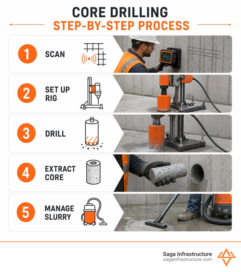
Step-by-step core drilling process infographic: scan, set up rig, drill, extract core, manage slurry infographic

Basic Core drilling services words to know:

What is Concrete Core Drilling?

Concrete core drilling is a way to make clean, round holes in concrete, stone, asphalt, or brick. A normal drill crushes everything in its path into dust. A core drill is different. It uses a hollow tube to cut only the outer edge of the circle. This leaves a solid cylinder of concrete, called a “core,” inside the tube. When you pull the drill out, the core comes with it. This leaves a perfectly smooth, round hole.

This method is the best way to cut concrete when you need to be exact. It lets workers make holes without shaking or damaging the rest of the wall or floor.

When you start a building project, you must make sure the ground is ready. That is why core drilling is a big part of The Groundwork Essentials for Your New Construction Project. Whether you are building in Clermont, Florida, or Phoenix, Arizona, making clean holes in concrete is a key step.

Core Drilling vs. Hammer Drilling

Why not just use a big hammer drill to make holes? The answer is about safety and keeping the building strong.

Hammer drilling uses brute force. It pounds the concrete over and over to break it. This heavy pounding sends strong vibrations through the wall or floor. These shakes can cause tiny, invisible cracks. Over time, these cracks make the concrete weak. If you use a hammer drill near important supports, the whole building could become unsafe.

Core drilling does not pound the concrete. Instead, it spins a diamond-tipped bit to shave the concrete away smoothly. It does not shake the building. This keeps the surrounding concrete strong and safe.

Here is how the two methods compare:

Feature Diamond Core Drilling Hammer Drilling
How it works Smooth spinning and cutting Heavy pounding and hitting
Shaking Very low (keeps concrete strong) High (causes tiny cracks)
Hole shape Perfectly round and smooth Rough, jagged, and uneven
Noise Steady and not too loud Extremely loud and annoying
Cutting steel Cuts through steel bars easily Gets stuck on steel bars
Dust Water traps the dust Makes a lot of messy dust

Using diamond-tipped bits lets workers cut through steel bars inside the concrete without stopping. It is clean, quiet, and safe.

Why Your Project Needs Professional Core Drilling Services

You might think you can drill concrete yourself. But professional core drilling services are needed for big projects. Concrete is very hard and heavy. Working with it requires big machines, steady hands, and special training.

Professional teams do three main jobs:

  • Putting in utilities: Making paths for water pipes, wires, and air vents.
  • Changing buildings: Making space for new stairs, elevators, or supports.
  • Taking samples: Cutting out small concrete cylinders so engineers can test how strong the concrete is.

Hiring experts means the job gets done right. It also keeps you from making bad mistakes, like cutting a live power line or weakening a wall.

Who Uses Core Drilling Services?

Many different businesses need core drilling. Builders use it to run pipes and wires through thick concrete floors and walls.

Road crews use it to install highway guardrails, traffic sensors, and streetlights. City workers also use it to connect new pipes to main sewer and water lines.

These jobs are a big part of building roads and cities. To learn more about how this works, read Everything You Need to Know About Heavy Earthmoving and Site Development. Every step of building needs to be done carefully.

How Core Drilling is Used Every Day

In construction, core drilling is used for these common tasks:

  1. Pipes and wires: Plumbers and electricians need clean holes for water pipes and power lines.
  2. Air vents: Large holes are cut in walls so fresh air can flow through the building.
  3. Big bolts: Workers drill holes to bolt down heavy steel beams or factory machines.
  4. Safety posts: Metal posts are set deep into concrete parking lots to protect buildings from cars.

These holes help keep water and utilities flowing. This is related to how we shape the land, which you can read about in The Essential Guide to Grading and Drainage Systems. Good drainage keeps your property dry and safe.

Technical Capabilities: Materials, Sizes, and Depths
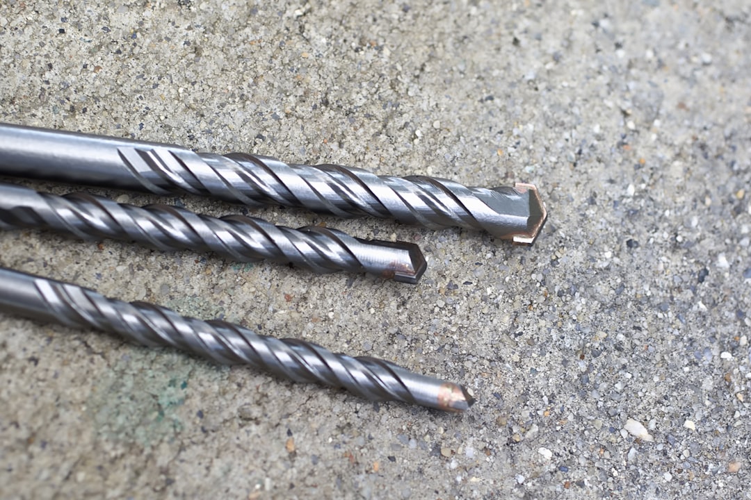
diamond core drill bits of various sizes

Modern core drills can cut through almost anything. Workers use them to drill through:

  • Concrete with steel bars inside
  • Asphalt roads and runways
  • Brick and cinder block walls
  • Hard stones like granite

To do this, they use special drill bits. These bits have tiny pieces of real diamonds on the edge. Since diamonds are the hardest thing on Earth, they can grind through concrete and steel easily.

For very deep holes, workers can connect extra metal tubes to the drill. This lets them reach deep into the ground or thick walls. This is very helpful for taking samples from deep inside dams, bridges, or foundations.

How Big and Deep Can They Go?

Drills come in many sizes. The tools must match the job.

  • Hole Width: Normal holes are 1 to 14 inches wide. But big industrial drills can make holes up to 72 inches wide!
  • Hole Depth: A normal hole through a wall might be 12 inches deep. But deep drills can go down 80 feet or more.
  • Power: Drills can run on electricity or fluid power (called hydraulics). Hydraulic drills are great for huge holes or wet areas where electricity is dangerous.

For jobs that need these big setups, you can learn more from experts like Concrete Core Drilling Services | 1′′–72′′ Holes | Americut. They can bring big drills to your site quickly.

Keeping Things Safe, Accurate, and Clean
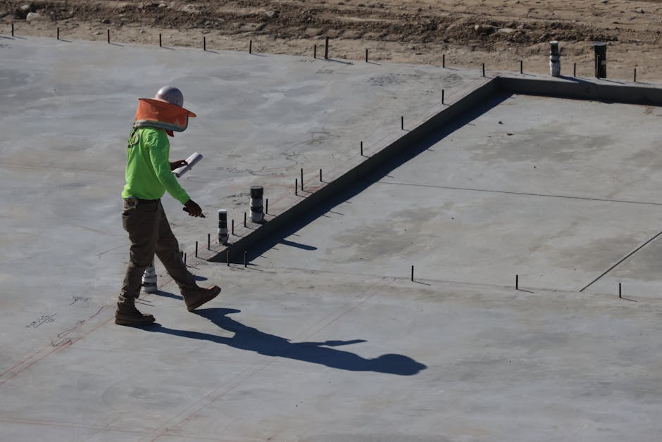
GPR scanning on a concrete slab

Safety is the most important part of any drilling job. Before drilling, workers must see what is hidden inside the concrete.

They use special radar (called GPR) and X-rays to look inside the concrete. This lets them find steel bars, strong cables, and live power lines without breaking anything.

Cutting a tight steel cable can make the concrete explode. Hitting a live wire can hurt workers or cause power outages. Scanning first keeps everyone safe and keeps the project moving. This careful safety step is just as important when leveling the ground, as you can read in The Straight Dirt on Land Grading and Leveling.

Using radar helps avoid bad mistakes. For example, The Concrete Sawing, Grinding, Coring and Scanning Experts – API Concrete Core Drilling specializes in scanning and dry drilling. They protect sensitive places like computer data centers, where a small mistake could shut down the internet.

Controlling Dust and Messy Mud

Drilling dry concrete makes a huge cloud of dust. Breathing this dust is very bad for your lungs. To stop this, workers use water while they drill.

Water runs through the drill bit. This does two things:

  1. It cools the diamond bit so it does not get too hot.
  2. It traps the dust and turns it into a wet mud called slurry.

This wet mud is very messy. You cannot wash it down the drain. Workers use special vacuums to suck up the mud as they drill.

This is very important when working inside schools, hospitals, or offices. In these places, workers use quiet electric drills and plastic walls to keep the air clean and the noise low. For indoor jobs, companies like Concrete Core Drilling Services use special cleanup tools to keep the area spotless.

How to Choose the Best Core Drilling Service

Choosing the right team is very important. You want a partner who works safely and has the right experience.

Here are a few questions to ask before you hire a contractor:

  • Do your workers have up-to-date safety training?
  • Do you scan the concrete with radar before you drill?
  • How do you clean up the messy mud, especially indoors?
  • Can you use quiet, electric tools inside?
  • Have you worked in our area before?

It is best to work with teams who know your local area. In Texas, companies like Core Drilling Services | Marek Sawing & Drilling do great work on highways and buildings. In Arizona, builders use Phoenix Area Core Drilling Services to get jobs done fast. In Florida, teams like Florida State Concrete Cutting & Core Drilling: Tampa Concrete … offer great services across the state.

Working with a team that has local roots and big-company resources is the best choice. This is how we build great things, as explained in From the Ground Up: Everything You Need to Know About Earthwork Construction Companies.

Frequently Asked Questions About Concrete Drilling

Can you drill inside buildings where people are working?

Yes, we do this all the time. When working in busy offices, stores, or hospitals, we use electric drills instead of gas ones. This means there are no bad fumes. We also put up plastic walls and use wet vacuums to catch all the water and mud. If the noise is too loud during the day, we can work at night or on weekends.

Can you drill at an angle or straight up?

Yes. Drilling straight down into a floor is most common. But we can also drill sideways through walls, at an angle for drains, or straight up into ceilings. For ceiling work, we use special stands and water rings to catch the messy water before it falls.

What changes the cost and time of a project?

A few things can change the price and timeline:

  • How hard the concrete is: Hard concrete with lots of steel takes longer to drill.
  • Hole size: Bigger and deeper holes need larger machines and more time.
  • Where the hole is: Working in tight spaces or high up takes extra setup time.
  • Water and power: If we have to bring our own water or generators, it can cost more.

Conclusion

At Saga Infrastructure, we believe the best work is built on trust, safety, and local skill. We support great local contractors. We give them the money and tools of a big national company, but we keep the local teams you already know and trust.

Whether you are putting in pipes in Clermont, Florida, or building a big project in Texas or Arizona, we have the tools and safety steps to do it right.

Ready to plan your next project? Let’s start the conversation. Let us work together to build the roads, pipes, and buildings that keep our towns moving forward.

Categories
Blog

Top-Tier GPS Land Surveying Equipment for Every Budget

Top-Tier GPS Land Surveying Equipment for Every Budget

Top-Tier GPS Land Surveying Equipment for Every Budget

Why the Right GPS Land Surveying Equipment Can Make or Break Your Project

GPS land surveying is now a key part of modern building work. It helps crews measure land with great care. It uses signals from satellites in space.

Need a quick answer on what to buy? Here is a simple guide:

Budget Equipment Type Typical Accuracy Best For
Under $200 Handheld GPS meter 1-5 meters Rough land size checks and simple maps
$1,000-$3,000 Entry RTK GNSS handheld 1-10 cm GIS work and farm maps
$5,000-$15,000 Mid-range RTK GNSS rover 1-2 cm Building layout and boundary work
$15,000+ Professional RTK GNSS system 8mm or better Legal surveys and large projects

Old survey tools often need a clear view from one point to another. GPS tools do not. This helps crews work faster. It also means fewer setups. It can work well in remote places and near the coast.

The world market for GNSS survey tools was about $2.8 billion in 2023. It may reach $4.5 billion by 2030. This shows that more teams are using satellite tools for careful work.

I’m Don Larsen, CEO of Saga Infrastructure. I lead a national group of local civil and utility companies. Our teams use GPS land surveying to build with care and trust. My work in construction helps me know which tools work well in the field.

Infographic comparing GPS vs GNSS surveying systems, accuracy levels, and key equipment tiers by budget infographic

Common GPS land surveying words:

What is GPS Land Surveying and How Does It Work?

Long ago, surveyors used tools that needed a clear view. They had to see from one point to the next. A hill, trees, or a building could slow the job down.

Modern GPS land surveying helps fix that problem. It uses satellites that move around Earth. A receiver on the ground listens to signals from many satellites. It measures how long each signal takes to arrive. Then it finds the exact spot on the ground.

Surveyor using an RTK rover rod for real-time kinematic GPS land surveying

Surveyors use a few main methods to get very careful results:

  • Static Baseline Surveying: This is very accurate. Surveyors place two receivers on steady points. The receivers collect satellite data for at least 20 minutes. Some jobs take hours. This can give results as close as 5 millimeters. It is good for setting control points on big job sites in Florida, Texas, or Arizona.
  • Real-Time Kinematic (RTK) Observations: RTK is used a lot in construction. It uses one fixed receiver called a Base. It also uses one moving receiver called a Rover. The Base sends fixes to the Rover by radio or internet. This gives the worker accurate points right away.
  • CORS (Continuously Operating Reference Stations) Networks: You may not need your own Base station. A CORS network can help. These are fixed stations that send correction data over the internet. A Rover can use this data to get RTK-level accuracy.

For more detail on these work methods and rules, read the Guidelines for the use of GNSS in surveying and mapping. You can also read our guide, The Ultimate Guide to Modern GPS Land Surveying Techniques.

Key Equipment Tiers for GPS Land Surveying

The right tool depends on your job and your budget. You do not need a $20,000 system to map a trail. But you should not build a bridge with a $150 handheld tool. Here are the main choices.

1. Consumer-Grade Handhelds and Meters (Under $200)

These are simple tools. Hikers and landowners often use them. Some handheld GPS land meters cost between $78.90 and $199.99.

  • Accuracy: Usually 1 to 5 meters.
  • Best For: Rough land size checks, basic property line checks, forestry, and simple maps.
  • Limits: They do not use RTK correction networks. They are not accurate enough for building layout or legal boundary fights.

2. GIS Data Collectors & Entry-Level GNSS ($1,000 – $3,000)

These tools are better than basic handhelds. They may look like strong tablets or phones. They can run mapping apps like the Land Map – GPS Land Survey & M app.

  • Accuracy: About 10 to 30 cm by itself. It may reach centimeter accuracy with a budget RTK antenna.
  • Best For: Utility maps, nature studies, asset tracking, and farm maps.
  • Limits: They may not work well under thick trees. They may not have advanced tilt tools found in top systems.

3. Professional RTK GNSS Systems ($5,000 – $20,000+)

These are the top tools for civil construction and engineering. They are built for hard work. Brands like Trimble, Leica, and high-end SMAJAYU systems are common in this group.

  • Accuracy: About 1 centimeter side to side. About 1.5 to 2 centimeters up and down.
  • Best For: Roads, foundations, utility digging, and legal boundary surveys.
  • Limits: They cost more. Crews also need training to use them well.

To learn what these accuracy levels mean on real jobs, read our guide on 5 Common Myths About Land Surveying Services.

Key Features to Look For in Professional GNSS Systems

If you plan to buy professional GPS land surveying tools, focus on what matters in the field. Do not get pulled in by fancy screens. Look for these features first:

High-precision GNSS receiver antenna mounted on a carbon fiber survey pole

Multi-Band Technology

Older GPS units listen to one signal type. This is often called L1. Better units listen to several types, like L1, L2, and L5. This helps the receiver spot and reduce errors. It also helps the tool start faster and stay accurate.

Multi-Constellation Support (GNSS)

People often say GPS for all satellite tools. But GPS is only the U.S. satellite system. GNSS means the tool can use many satellite systems at once:

  • GPS (United States)
  • GLONASS (Russia)
  • Galileo (Europe)
  • BeiDou (China)

When a receiver can see more satellites, it works better. It may track 30 or more satellites instead of only 8 or 10. This helps near trees, tall buildings, and deep valleys. For official guidance, see the RICS standard on the Use of GNSS in land surveying and mapping.

IMU Tilt Compensation

In the past, a surveyor had to hold the pole perfectly straight. If the pole tilted, the point could be wrong. Modern receivers can have an IMU. This sensor knows how much the pole is tilted. It can still find the right ground point. This can make field work faster. It can also help workers stay safer on slopes.

Ruggedness and Battery Life

Survey tools must handle rain, mud, heat, and drops. Look for an IP67 or IP68 rating. This means the tool is protected from dust and water. Also look for batteries you can swap without turning the tool off. This helps keep the satellite connection.

Key Uses of GPS Land Surveying in Modern Infrastructure

At Saga Infrastructure, we see these tools help on real jobs every day. We use GPS land surveying for water lines in Clermont, Florida. We use it for large sites in Texas. We use it for utility paths in the Arizona Sun Corridor. It helps every part of the job stay on track.

1. Civil Construction and Site Grading

Before a bulldozer moves dirt, our teams map the land with RTK GNSS tools. This map can go into GPS-guided machines. The machines use a 3D model to guide their blades. This helps shape the site the right way. It can also help stop flooding and protect buildings.

2. Utility Installation and Asset Mapping

When crews install water, sewer, or gas lines, exact locations matter. We record the location of each pipe and valve before the trench is covered. This creates a clear digital map. Years later, crews can find a buried valve fast. This helps avoid damage and danger.

3. Boundary and ALTA Surveys

For commercial real estate, buyers need to know the exact property lines. They also need to know about easements and anything that crosses a line. Professional GNSS tools help surveyors connect local property corners to trusted national data.

To see how these surveys protect your investment, read Demystifying the ALTA Survey for Real Estate Professionals and Navigating Commercial Real Estate: A Comprehensive Guide to Surveys.

Frequently Asked Questions About GPS Land Surveying

How accurate is GPS land surveying compared to older methods?

Older tools, like total stations, can be very accurate over short distances. But they need a clear view. They also need more setup time. RTK GNSS tools can reach centimeter-level accuracy across large areas. They are often about 1 cm accurate side to side and 1.5 cm up and down. For legal boundary work, surveyors may use both GPS and older tools to check the results. You can learn more in this guide on the Purpose: GPS Cadastral Survey Procedure, Leica GPS System 1200.

What is the difference between GPS and GNSS in GPS land surveying?

GPS is a satellite system run by the United States. GNSS is the larger name for all satellite systems. It includes GPS, Russia’s GLONASS, Europe’s Galileo, and China’s BeiDou. A professional survey receiver is usually a GNSS receiver. This means it can use many systems at once.

How do trees, buildings, and weather affect RTK GNSS accuracy?

GNSS tools need signals from satellites. Trees, tall buildings, and cliffs can block those signals. Metal objects and water can also bounce the signals. This can cause wrong readings. Surveyors check signal quality before they trust a point. If satellite signals are poor, they may use optical tools instead.

Conclusion

Buying the right GPS land surveying tools is not about picking the most costly option. It is about choosing the right tool for your job, your team, and your land.

At Saga Infrastructure, we know strong projects need good tools and local know-how. We partner with strong local civil and utility contractors. We give them national scale, capital, and better technology. We also protect their local names, teams, and legacies.

One example is our partnership with Foshee Construction in Minneola, Florida. Foshee has deep roots in its community. Saga brings national support and resources. Together, we help deliver careful work on important projects in the region.

If you are a local contractor looking to improve your field tools, we can help. If you are a founder thinking about your company’s future, we can help too.

Let’s talk. Visit Saga Infrastructure to learn how we join local skill with national strength.

Categories
Blog

Why Your Property Needs an Environmental Clean Bill of Health

Why Your Property Needs an Environmental Clean Bill of Health

Why Your Property Needs an Environmental Clean Bill of Health

Why Checking Your Property for Problems is Very Important

Environmental due diligence is a way to check a property for problems before you buy it. Here is what it covers:

  • What it is: A deep look at the history and health of a piece of land.
  • Why it matters: It stops buyers from having to pay for old messes they didn’t make.
  • When it’s needed: Before buying land, getting a loan, or starting a big project.
  • Key steps: A first look at the surface (Phase I) and a deeper look at soil and water if needed (Phase II).
  • Who it protects: People buying land, banks, and builders.

Every piece of land has a story. Sometimes that story includes old chemicals or leaky tanks. A simple search won’t find these things. If you don’t check, you might have to pay a lot of money to clean it up. This can cost more than the land is worth!

In the U.S., the law says you can be responsible for a mess even if you didn’t cause it. This is a big risk for any deal.

The good news is that the right check can protect you.

I’m Don Larsen, CEO of Saga Infrastructure. I have worked in building and development for a long time. I have seen how environmental due diligence can save a deal. I will show you how this process works and how it keeps your money safe.

Environmental due diligence lifecycle from Phase I ESA to CERCLA liability protection and land use controls infographic

Learn these terms:

What is Environmental Due Diligence and Why Does It Matter?

Environmental due diligence is like a research mission. It is how we look “under the hood” of a property. We want to see if there are any hidden problems. Whether you are in Florida or Arizona, you need to know if the land is healthy.

What is Environmental Due Diligence? – Cobb Cole says this process looks for risks. It is very important for people who build things or lend money. It helps us make sure the land is safe before any money is spent.

Why Real Estate Needs It

In business, this isn’t just a good idea—it is usually required. Banks will not give you a loan without a clean report. The government also wants to see these reports before they help pay for land projects.

Think of it like a survey. You wouldn’t build a fence without navigating commercial real estate through a comprehensive guide to surveys. You shouldn’t buy land without knowing its history. Your bank will want to see these reports to keep their money safe.

Three Kinds of Risk

We look at three types of risk:

  1. Direct Risks: This is the cost to fix a problem, like cleaning up lead in the soil.
  2. Indirect Risks: Even if you fix it, the land might be worth less money later.
  3. Reputational Risks: People might not trust your business if you are linked to a dirty site.

How the Check Works

Environmental consultant reviewing historical records and regulatory databases

How do we do this? We start by building a team. This team includes lawyers and experts.

Steps in the Process

This is more than just walking around. It includes:

  • Looking at Old Records: We look back many years. Was the land a gas station or a farm?
  • Government Records: We look for old spills or rules that were broken.
  • Interviews: We talk to people who used to live or work there.
  • Visual Inspections: An expert walks the land. They look for stained dirt or dead plants.

Before you start building, you should look at a complete checklist for commercial site preparation.

Simple Tools

Not every property needs a big check. Sometimes we use simple tools:

  • Questionnaires: A list of questions about the land.
  • Desktop Reports: Checking computer records without visiting the site.
  • Transaction Screens: A quick look for low-risk land.
  • ALTA Surveys: These show the borders of the land. Demystifying the ALTA survey for real estate professionals shows how these help find problems.

Learning About Phase I and Phase II Checks

The best way to check land is a Phase I Environmental Site Assessment (ESA). We follow the newest rules from E1527 Standard Practice for Environmental Site Assessments: Phase I Environmental Site Assessment Process.

A Phase I check looks at the surface. It looks for “RECs.” These are signs that chemicals or oil might be on the property. This check does not involve digging.

When is a Phase II Needed?

If the Phase I report finds a red flag, you need a Phase II check. This is when we dig into the ground.

Environmental drill rig collecting subsurface soil cores for analysis

A Phase II check takes samples of:

  • Soil
  • Water under the ground
  • Air in the soil
  • Building materials

The goal is to see if there is a real mess and how big it is.

What the Results Mean

We send the samples to a lab. We check if the chemicals are above safe limits. If they are, we make a plan to clean it up. This might mean moving dirt or cleaning the water.

How These Checks Protect You from the Law

We do this work because of a law called CERCLA. This law is very tough. It says you can be blamed for a mess even if you didn’t make it.

To stay safe, you must do “All Appropriate Inquiries.” This means doing a proper Phase I check. This gives you “Landowner Liability Protections.”

The Innocent Landowner Defense

This is for people who bought land and didn’t know it was dirty, even though they checked. To use this, you must do a Phase I check before you buy the land. You must also be careful not to make the problem worse.

Bona Fide Prospective Purchasers

Even if you know land is dirty, you can still buy it safely. You can be protected if you:

  1. Do a check before buying.
  2. Did not cause the mess.
  3. Follow all the rules for the land.
  4. Stop any new leaks.

A law from 2018 even helps people who rent dirty land stay safe.

More Than Just Chemicals

Most people think about chemicals. But there is more to the environment. We look at two main things:

Feature Traditional (TEDD) Natural Resources (NREDD)
Focus Chemicals and oil Wetlands and animals
Goal Legal protection Getting permits
Tools Phase I & II checks Wetland and animal surveys
Risks Cleanup costs Project delays

Rules for the Land

Sometimes the best way to handle a mess is to leave it and cover it up. This uses special controls:

  • Engineering Controls: Things like a concrete floor or a fence to keep people away from dirt.
  • Institutional Controls: Legal rules that say you cannot build houses or drink the water there.

Taking Care of the Land

If you buy land with these rules, you must follow them forever. You have to keep the covers in good shape. We make sure these rules are clear before you sign any papers.

Timing and Tips for a Good Deal

Timing is very important. If your report is too old, it will not work for the law.

  • The One-Year Rule: Your Phase I check must be done within one year of buying the land.
  • The 180-Day Update: Some parts of the report must be updated if they are older than 180 days.

We suggest that a lawyer should hire the expert. This helps keep the information private. Your lawyer should also check the contract to make sure you are protected if the expert misses something.

Common Questions

How long is a Phase I report good for?

It lasts for one year. But some parts must be updated after 180 days.

How much does it cost?

A Phase I check can cost between $1,000 and $10,000. A Phase II check costs much more because of the digging and lab tests.

Can a quick screen replace a Phase I?

A quick screen is cheaper, but it does not give you the same legal protection. It is okay for very safe land, but it won’t shield you from big costs like a Phase I does.

Conclusion

At Saga Infrastructure, we believe the best way to build is to respect the land. Whether we are in Texas or Florida, we want to know the land is healthy. This is the start of every good project.

We don’t just buy companies. We partner with people to keep their hard work growing. We use our resources to make sure every project is on safe ground.

If you want to buy or sell land and stay safe, let’s start the conversation about your infrastructure project. We help protect what you have built so it can grow for a long time.

Categories
Blog

The Ultimate Guide to Modern GPS Land Surveying Techniques

The Ultimate Guide to Modern GPS Land Surveying Techniques

The Ultimate Guide to Modern GPS Land Surveying Techniques

How GPS Land Surveying Works — And Why It Matters for Modern Infrastructure

GPS land surveying has changed how we measure the world. It used to take weeks to measure land. Now, it only takes a few hours. It is also more accurate and needs fewer people.

Here is what you need to know:

Method How Accurate Best Use
Static GPS Very exact (5 mm) Making main map points
RTK Centimeter level Building and property lines
CORS Network A few centimeters Big areas
Handheld tool Under 1 meter Simple maps
Phone app 3–5 meters Just for fun at home

The technology is simple. GPS tools on the ground talk to satellites in space. They find the exact spot on Earth. It works in any weather. You do not even need to see from one point to the next. This helps on big sites or in the woods.

Today, builders and city planners use GPS to make fast choices about land and pipes.

But not all GPS tools are the same. The way you use them matters. It decides if your map is good enough for the law.

I am Don Larsen, the head of Saga Infrastructure. I work with builders every day. I know how important it is to have a good gps land survey. This guide will help you pick the right tools for your project.

Infographic showing how satellite signals are processed into survey-grade ground coordinates via GPS receiver, base station

Terms related to gps land survey:

What a GPS Land Survey Is and How It Compares to Traditional Surveying

A GPS land survey uses satellites and special tools to find spots on the ground. Most pros use a system called GNSS. This system uses many groups of satellites from different countries. More satellites make the work faster and better.

Old-style surveying uses tools that look through a lens. Those tools measure angles and distances between points you can see.

How a gps land survey works in simple terms

Satellites send out signals. A tool on the ground listens to many satellites at once. It uses those signals to find its spot. For professional work, we use a second signal to fix small errors:

  • A base station that stays in one spot
  • A rover that moves around
  • Or a network of stations that sends fixes

This makes the map much more exact than a phone GPS.

GPS surveying vs traditional optical methods

GPS and old tools work together. They are like a team.

GPS is good because:

  • You do not need to see between points
  • It is fast on big, open land
  • You need fewer people to do the work

Old tools are good because:

  • They work under trees and near tall buildings
  • They are great for small details
  • They work when satellites are blocked

Old tools need a clear view. GPS needs a clear sky. Surveyors pick the best tool for the job.

GPS rover and total station side by side on a job site

When surveyors use GPS alone and when they combine methods

In open fields, GPS might do all the work. In the woods or in a city, surveyors use both. They use both when trees block the sky or when they need to be extra careful. To learn more about common mistakes, read these land surveying myths.

The Main GPS Surveying Methods: Static, RTK, and CORS

There are three main ways to use GPS for surveying. Each one has a different speed and accuracy.

Static GPS for the best accuracy

Static GPS is the slow way. You put two or more tools on points for 20 minutes or more. Then you use a computer to find the exact spot. This is best for making the main points that the whole map will use.

RTK for fast work

RTK stands for Real-Time Kinematic. It is very fast. A base station sends fixes to a moving tool. This gives you a spot within a few centimeters in just seconds. It is great for building and mapping pipes.

RTK GPS base station and rover setup in open terrain

CORS networks

CORS is a group of permanent stations. Instead of setting up your own base, you use the network. This is good for big areas and saves time. For more rules on this, see the RICS GNSS guidance note.

Which method to choose

Method Best for Limits
Static Main points Takes a long time
RTK Fast site work Needs a clear sky
CORS Big regions Needs a phone signal

Equipment, Software, and Cost for Professional GPS Land Surveying

Professional GPS is more than just a stick. It is a whole system.

What a crew needs

A pro setup includes:

  • A high-quality GPS receiver
  • A special antenna
  • A pole to hold the tool
  • A computer to save data
  • Software for the office

How much it costs in 2026

Professional gear is expensive. One receiver can cost $4,000 to $10,000. A full kit can cost over $20,000. You also have to pay for software and training.

Infographic comparing GPS survey equipment cost tiers and accuracy ranges infographic

Can phone apps do the job?

No. Phone apps are okay for a homeowner to guess where a line is. But they are not exact. A phone might be off by 15 feet. That is too much for a real survey. Apps like Land Map – GPS Land Survey & M can help, but they do not replace real tools.

If you are planning to build, this site preparation checklist can help you use your survey data.

Accuracy, Limits, and Error Sources in GPS Surveying

How accurate is it?

A gps land survey can be very exact. Some methods can find a spot within a few millimeters. RTK is usually within a few centimeters. Phone GPS is much worse.

What makes it less accurate?

Many things can cause errors:

  • Trees and leaves
  • Tall buildings
  • Signals bouncing off walls
  • Bad weather
  • Not enough satellites in the sky

GPS vs GIS

GPS finds the spots. GIS is the map that holds all the info. It shows where pipes, land lines, and trees are. This helps people make good plans. For more on building, see our groundwork guide for new construction.

Rules for surveys

For property lines, being exact is a legal rule. There are special standards for these surveys. GPS can be used, but the surveyor must follow the law. You can see the rules here: 2026 ALTA/NSPS Land Title Survey standards.

How a survey is done

A surveyor does these steps:

  1. Look at old records
  2. Find old markers in the ground
  3. Use GPS to find points
  4. Check the work twice
  5. Make a final map

For more help, see this GPS cadastral survey procedure.

Why a person is better than a machine

A GPS tool only gives numbers. It does not know who owns the land. A licensed surveyor has to look at old deeds and markers to decide where the line really is. For more on this, see our ALTA survey overview.

Frequently Asked Questions About GPS Land Surveying

Can GPS find my property lines by itself?

No. GPS finds spots, but it does not know the law. A surveyor must look at old papers and markers to find the real line.

Is RTK good enough for a property survey?

Yes, if the sky is clear and the surveyor checks the work. Sometimes they use other tools too just to be sure.

How much does the gear cost?

A full professional setup usually costs more than $10,000. This includes the tools, the computer, and the software.

Conclusion

GPS land survey tools help teams get data fast. They work well for big areas. Using GPS with other tools helps build better roads and buildings.

At Saga Infrastructure, we know that good building starts with good facts. Exact surveys help keep projects safe and on track.

To learn more about surveys for big projects, read our guide to commercial real estate surveys. To see more of what we do, start here.

Categories
Blog

Solar Farm Erosion Control: Protecting Your Green Investment

Solar Farm Erosion Control: Protecting Your Green Investment

Solar Farm Erosion Control: Protecting Your Green Investment

Understanding the Risks of Solar Farm Erosion Control

Solar farm erosion control is very important. It is a big problem that people often forget when building solar farms.

Here is a simple list of ways to stop erosion:

Method When to Use Why it Helps
Silt fences & filter socks While building Slows down water, catches mud
Cleaning small areas While building Keeps most of the dirt covered
Special blankets On hills Protects the ground right away
Planting grass After building Keeps soil in place for a long time
Water paths & ponds On hard land Moves rain water safely
Soft mats Under panel edges Cheap and helps grass grow
Drones Every day Finds problems early

Solar panels are like big umbrellas. Rain hits the panels and slides off the edges. This water moves fast and hits the ground hard. This can wash away the dirt and hurt the metal legs that hold the panels. It can also turn nearby lakes into mud.

This is a big deal. In one study, 7 out of 10 solar farms did not follow the rules for mud and water. One company had to pay $135.5 million because mud from their site ruined a neighbor’s lake.

But there is good news: you can stop erosion. Experts from big schools say that if you plant grass and use the right tools, solar farms can keep the land healthy—even on hills.

The difference between a good solar farm and a bad one is how you take care of the land while you build.

I am Don Larsen. I lead Saga Infrastructure. We work with local builders to make sure solar farms are built the right way. We want to protect the land and your money. In this guide, we will show you how to keep your solar site safe.

Solar farm water cycle showing drip line runoff, soil moisture zones, and stormwater flow paths - solar farm erosion control

Solar farms look clean and quiet. But under the panels, water can be a problem. If you do not have a plan for solar farm erosion control, the ground can wash away.

Different Kinds of Erosion

  • Water Erosion: Rain slides off panels and gathers speed. It starts to carve deep holes in the dirt.
  • Drip Line Holes: Water dumps off the edge of the panel in a line. This makes the ground very wet in one spot and dry in another. This makes the soil weak.
  • Wind Erosion: In dry places, wind can blow away the top layer of dirt.
  • Hill Problems: Water moves faster on hills. Without grass or mats, the soil slides down.

soil rills and erosion gullies forming under solar panel rows - solar farm erosion control

Why it Matters

If the dirt washes away, the solar panels can fall over. It costs a lot of money to fix these problems. Also, you can get in trouble with the law. One company had to pay $135.5 million because mud from their site ruined a neighbor’s lake. Erosion Control in Solar Farms: Do Solar Farms Damage the Soil is a big question. The answer is: only if you don’t take care of the land. You can learn more in our Step-by-Step Guide to Erosion Control Solutions.

Getting the Land Ready

The most dangerous time for a solar farm is when it is being built. This is because the grass is gone and the dirt is open. At Saga Infrastructure, we know that digging too much can hurt the soil. It can pack the dirt too tight or take away the good dirt that plants need.

The 10-Acre Rule

A good rule is to only dig up 10 acres at a time. By working in small parts, you keep the rest of the land safe from rain.

Tools for Building

We use these tools to stop water and mud:

  • Silt Fences & Filter Socks: These act like filters to catch dirt before it leaves the site.
  • Compost Filter Socks: These are heavy tubes that stop mud. They work well on rocky ground.
  • Planting Grass Fast: You should plant grass as soon as you finish a small area. Don’t wait until the end. Planting grass like clover helps keep the dirt in place and saves money.

Whether you are in Arizona or Florida, being ready is key. Use our Complete Checklist for Commercial Site Preparation to help. Learning about The Groundwork Essentials for Your New Construction Project can save your project.

Ways to Stop Erosion

After the panels are up, you need to keep the land healthy. New studies show that if you have good grass and water paths, solar farms can be great for the land.

Before and During Building

We look at the soil and the hills before we start.

  • Grass Strips: We keep natural grass around the edges of the site.
  • Special Blankets: We use blankets made of fiber to protect the dirt while new grass grows.
  • Clean Driveways: We use stone pads so trucks don’t get mud on the roads.

Long-Term Care

After the builders leave, the work continues.

  • Managing Grass: We pick special grass that helps bees and butterflies. This also keeps the soil strong.
  • Farming with Solar: Some people let sheep eat the grass under the panels. This keeps the land healthy.
  • Water Paths: We check the paths and ponds often. If they get filled with mud, they won’t work.

We use drones to take pictures of the site. These pictures help us find small holes before they become big problems. For more help, the NRCS Conservation Considerations for Solar Farms is a great resource.

Picking the Best Tools

You can use rocks or soft mats to protect the ground. For a long time, people used big rocks. But at Saga Infrastructure, we think rocks are not always the best for solar farms. Rocks are heavy and expensive. Also, if a mower hits a rock, it can fly up and break a solar panel.

Why Soft Mats are Better

Soft mats work very well. They protect the ground better than just grass. They also cost about half as much as rocks.

Feature Big Rocks Soft Mats
Speed Slow to put down Fast to roll out
Care Hard to mow Easy to mow
Safety Can break panels Very safe
Cost High Low
Look Like a construction site Like a green field

Following the Rules

The government has strict rules about mud and water. Many sites have failed these rules. You do not want to pay big fines. Using good tools from the start is the best way to save money. To learn why rocks aren’t always the best, read The Ultimate Riprap Erosion Defense.

Common Questions

Do solar farms hurt the soil?

Not if they are built right! Solar farms can actually help the land. By planting grass and not using chemicals, the soil can get healthier over 25 years. The key is to not dig up the land too much.

What is drip line erosion?

This happens when rain runs off the panels and hits the ground in a hard line. It is like a giant umbrella dumping water in one spot. This can dig deep holes near the metal legs of the panels. If the holes get too deep, the panels might fall over.

How do drones help?

Drones are great for finding erosion. A drone can fly over the whole farm in an hour. It takes pictures that show us where grass is dying or where holes are starting. This lets us fix the problem fast.

Conclusion

At Saga Infrastructure, we believe in clean energy and healthy land. We work with local builders who know their soil best. We help them build solar farms that last a long time.

Solar farm erosion control is about more than just dirt. It is about protecting the land and the community. Whether you are in Florida, Texas, or Arizona, we are here to help.

Want to make sure your project is built right? Download our Ready-Set-Build Checklist and let’s talk about your land.

Categories
Blog

The Straight Dirt on Land Grading and Leveling

The Straight Dirt on Land Grading and Leveling

What Land Grading Services Actually Do (And Why It Matters for Your Property)

Land grading services fix the ground on your property. They move dirt so water flows away and the ground stays strong for building.

Here is what you need to know:

  • What it is: Moving and packing dirt to make the ground flat or slanted the right way.
  • Why it matters: Without it, water can pool near your house and damage the walls.
  • Who needs it: People building new houses, driveways, or pools.
  • What it costs: Small jobs cost a few hundred dollars. Big jobs cost more.
  • How long it takes: Most jobs take a few days to a week.

Grading is the first step in building. If it is done right, your land will stay safe for a long time. I am Don Larsen, CEO of Saga Infrastructure. I have worked on many building projects. I know how important good grading is. This guide will help you understand how it works.

5-step land grading process infographic showing site assessment, clearing, rough grading, compaction, and finish grading

Land grading services terms to remember:

What are Land Grading Services and Why Do They Matter?

bulldozer shaping a slope for land grading - land grading services

Land grading is making the ground flat or slanted. This helps prepare the land for a house or a yard. The goal is to make sure water goes where it should.

We don’t just move dirt for fun. We shape it to keep your house dry. Professional land grading services use plans to keep your soil in place.

Proper GRADING SERVICES are very important. They protect your home from water damage. You can learn more in The Essential Guide to Grading and Drainage Systems.

Signs Your Property Needs Help

Sometimes you can see when your land has problems. Look for these signs:

  • Puddles: If you see mini lakes after it rains, your ground is not slanted right.
  • Wall Cracks: Water pushing against your house can cause cracks.
  • Dirt Washing Away: If rain makes “rivers” in your dirt, the slope is too steep.
  • Squishy Grass: A lawn that stays wet for days needs to be leveled.
  • Bumpy Ground: Bumps make it hard to mow and can make you trip.

Grading for Building

Before you build, the ground must be ready. This is part of The Groundwork Essentials for Your New Construction Project. We use grading for:

  • Building Pads: A flat, hard area for a house to sit on.
  • Driveways: Making the middle higher so water runs off the sides.
  • Pools: Pools need the ground to be perfectly level.

The Main Benefits of Professional Land Leveling

When we provide land grading services, we make your land better. A well-graded lot is the start of Grading Services – Palmetto Land Services. It keeps your yard healthy and your house safe.

Preventing House Damage

Fixing a house foundation is very expensive. Grading helps stop this. It moves water away from the building. This keeps the basement dry and the walls strong.

Creating Better Yard Space

Do you want a patio or a shed? Grading can make a hilly yard flat. We can turn a slope into flat areas for gardens or play. If you want to build a shed, check out How to Prep Your Shed Site Like a Pro.

Common Types of Land Grading Services

Not every job is the same. Companies like Grading & Land Leveling Services Chesterfield VA offer different types of work.

Rough Grading

This is the big work. We use large machines to move lots of dirt. We cut down hills and fill in holes. This is part of From Dirt to Driveway: Mastering Grading and Paving. For big projects, we use a Complete Checklist for Commercial Site Preparation.

Finish Grading

This is the final step. We make the top layer of dirt very smooth. This makes it ready for grass or sod. As KG Landscape says, this makes a site look like a finished home.

Drainage Grading

Sometimes you just need to move water. This includes:

  • Swales: Grassy ditches that act like pipes.
  • French Drains: Pipes under the ground that carry water away.
  • Berms: Small hills that block water. You can see more at LAND GRADING.

A Step-by-Step Guide to the Grading Process

We follow a plan to get the job done. You can find Local Excavation Services Without Breaking a Sweat, but it helps to know the steps.

Planning

We never just start digging. First, we look at maps to see where water flows. We check the soil and look for underground pipes.

Doing the Work

  1. Rough Cuts: We move the big piles of dirt.
  2. Adding Dirt: We add dirt in thin layers.
  3. Packing: We use heavy rollers to pack the dirt down tight.
  4. Smoothing: We use lasers to make sure the ground is flat.
  5. Checking: We check the drainage one last time. Robinson Landscape says this final check is very important.

Equipment and Expertise: How the Pros Level the Ground

To do this right, you need big machines. Professional land grading services use:

  • Bulldozers: To move huge amounts of dirt.
  • Excavators: To dig deep holes or trenches.
  • Skid Steers: Small machines for tight spots.
  • Laser Levels: Tools that measure the ground perfectly.

Using the right tools is important. You can see how contractors compare at The 5 Best Site Preparation Contractors Compared. In Arizona, pros like MR Tanner Construction use special tools for rocky ground.

Why Being Precise Matters

In grading, one inch can change everything. We use lasers to make sure water moves away from your house. We don’t guess; we measure.

Different States, Different Soil

Where you live changes the work.

  • Florida: The soil is sandy. Moving water is the main goal. South Lake Loader Service knows how to work with this soil.
  • Texas: The clay soil can grow or shrink. We have to pack it down very well.
  • Arizona: The ground is hard and rocky. We have to plan for fast rain storms.

Frequently Asked Questions about Land Grading Services

How much does land grading cost?

It depends on the job. A small yard might cost $500 to $1,500. A big building site can cost much more.

Infographic comparing grading costs for small yards, house pads, and commercial lots infographic

Do I need a permit?

Usually, yes. Local rules often require a permit if you move a lot of dirt. Florida Landworx can help you with these rules.

How long does it take?

Most house projects take 1 to 3 days. If it rains, it will take longer because we cannot work in mud.

Conclusion

At Saga Infrastructure, we want to build on strong ground. We support local companies that know their area well. Whether you have sandy soil in Florida or rocky ground in Arizona, we can help.

We are a group of builders who care about our towns. We give local businesses the help they need to grow.

If you are ready to start your project, land grading services are the first step. Let’s start the conversation and see how we can help you build something great.

Categories
Blog

Everything You Need to Know About Heavy Earthmoving and Site Development

Everything You Need to Know About Heavy Earthmoving and Site Development

What Earthwork Contractors Actually Do (And Why It Matters)

Earthwork contractors are experts who get the land ready. They make sure the ground is safe for buildings, roads, and pipes.

Here is a simple list of what they do:

  • Mass excavation: Moving large volumes of soil and rock to shape the site for construction.
  • Grading: Adjusting the ground to create the right level surfaces and drainage slopes.
  • Site preparation: Clearing the land, removing unsuitable material, and compacting soil for stability.
  • Utility installation: Placing underground systems like water, storm, and sewer lines.
  • Environmental work: Protecting soil and water through erosion control, sediment management, and remediation.

They work on many things like stores, roads, and solar farms.

Nothing can be built without this work. Every building and road needs a strong base.

Choosing the right partner is very important. A bad choice can cost a lot of money and cause delays. A good choice makes the whole project go well.

I am Don Larsen. I lead Saga Infrastructure. We work with great earthwork contractors. I have seen how the best teams work from the ground up.

Step-by-step site preparation process from clearing to final grading infographic - earthwork contractors infographic

Key terms for earthwork contractors:

Core Services Provided by Earthwork Contractors

Earthwork is more than just digging holes. Modern earthwork contractors do many jobs to turn wild land into a flat spot for building. This is called a “pad-ready” site.

Construction crew installing underground utility pipes at a new development site - earthwork contractors

Mass excavation is a big part of the job. It means moving huge amounts of dirt. For big projects, teams might move enough dirt to fill thousands of trucks.

Site prep also includes clearing the land. This means taking away trees and old buildings. You can see how this works in big infrastructure projects where many jobs happen at once.

Putting in Pipes and Sewers

Earthwork contractors also put pipes deep in the ground. This must happen before the building starts.

This includes:

  • Stormwater Pipes: These carry rain away so the land does not flood.
  • Sewer Lines: These carry waste away from buildings.
  • Water Mains: These bring clean water for drinking and fire safety.

In places like Florida and Texas, moving water is very important. Contractors make sure the land stays dry for a long time.

Making the Ground Level

After the big digging is done, the ground must be leveled. This is called grading. It makes sure the land is flat or has the right slope for water to run off.

Contractors use big rollers to pack the dirt down tight. If the dirt is too loose, roads and parking lots will crack. Earthwork contractors make sure the ground is ready for the next crew to build the foundation.

Specialized Projects and Market Sectors

Earthwork contractors work on many different types of jobs. Some jobs are at airports, and some are near the ocean.

In Florida, there is a lot of work for Sitework, Grading & Utility Installation. As more people move there, new roads and pipes are needed. A good example is the Hills of Minneola Crooked Can Infrastructure project.

Roads and Energy Projects

Earthwork is the base for everything we use. This includes:

  • Highways: Building the dirt base for new roads.
  • Energy: Getting land ready for big solar farms.
  • Landfills: Building safe places for trash.
  • Bridges: Digging deep holes to hold up heavy bridges.

In places like Arizona, the ground can be very hard. Contractors there use special tools to break through tough rocks.

Helping the Environment

Earthwork is also about fixing the land. Contractors help clean up dirty soil or fix natural areas like wetlands. They also stop dirt from washing away into the water. These jobs take a lot of care and the right machines.

Advanced Technology and Equipment

Workers do not just guess anymore. Modern earthwork contractors use expensive tools and computers to get the job done right.

GPS machines are a big help. A computer map of the site is put into the bulldozer. The driver can see exactly where to move the dirt. The machine can even move its own blade to the right height.

Infographic comparing traditional grading and GPS-guided grading infographic

Drones are also used. They fly over the site to take pictures and measure how much dirt is in a pile. This helps us tell the customer exactly what is happening.

Big Machines for Big Jobs

To move a lot of dirt, you need many big machines. Top companies own hundreds of them.

A typical fleet has:

  • Big Excavators: For deep digging.
  • Dump Trucks: For carrying heavy loads over bumpy ground.
  • Rollers: For packing the dirt down.
  • Loaders: For moving dirt in small spaces.

Keeping these machines running is a big job. Good contractors have their own shops and mechanics to fix them quickly.

Safety and Taking Care of the Land

Safety is the most important thing. We work around big machines and deep holes. We want every worker to go home safe at the end of the day.

Our teams get special training to work on sites that might have dirty soil. We also learn how to keep dirt from washing into rivers. You can read more about this on our About Us page.

How We Help the Environment

We try to be green by using the “Three Rs”: Reduce, Reuse, and Recycle.

  • Recycle: We crush old concrete to use it again for new roads.
  • Reuse Soil: We try to keep soil on the site instead of moving it far away.
  • Stop Erosion: We use fences and plants to keep dirt from washing away.

This helps the earth and can also save money.

How to Pick the Right Partner

Choosing an earthwork contractor is not just about the lowest price. You need a team with the right tools and a good name.

When you look for a contractor, ask:

  • Experience: Have they done this kind of work before?
  • Tools: Do they own their own machines?
  • Reputation: Do other people like their work?
  • Safety: Do they have a good safety record?

Our Saga Team is made of local experts who have worked in their towns for a long time.

The Bidding Process

Bidding is now done on computers. This makes it faster. When you ask for a price, give the contractor all the maps and soil reports you have. This helps them give you a fair price.

A contractor who knows the local rules can save you a lot of time and trouble.

Frequently Asked Questions

What is the difference between digging and grading?

Digging (excavation) is making a hole or a trench. Grading is making the ground flat or sloped so water flows the right way.

How do contractors keep the water clean?

They use special fences to stop dirt from running off. They also use water trucks to keep dust down. Many managers have special training to protect the environment.

Why is GPS used in earthwork?

GPS is very exact. It helps workers know exactly where to dig without using wood stakes. This makes the job faster and cheaper.

Conclusion

At Saga Infrastructure, we know every big project starts with the ground. We are proud to help build the roads and buildings that people use every day. We combine local skill with big resources to build things that last.

Whether you are building a new neighborhood, a big factory, or a solar farm, the right earthwork contractors make a big difference. We want to help you build the future.

Let’s build together. Visit us at sagainfrastructure.com/ to talk to us.

Categories
Blog

5 Top Site Testing Services Revealed

5 Top Site Testing Services Revealed

Why Site Testing Services Are Critical for Quality, Performance, and Growth

Site testing services are ways to check if a website or app works right. They make sure everything is safe and easy to use for everyone.

Here is a quick look at what they do:

  • Functional Testing – Checks whether buttons, links, forms, and key features work the way they should.

  • Cross-Browser Testing – Confirms the site performs properly across different browsers and computer setups.

  • Mobile App Testing – Tests how the experience works on phones, tablets, and other mobile devices.

  • Accessibility Testing – Verifies the site is usable for people with different abilities and accessibility needs.

  • Visual Testing – Reviews layouts, spacing, and design elements to catch display issues.

  • UX Testing – Looks at how real users interact with the site and where they may get stuck.

  • AI-Automated Testing – Uses intelligent tools to speed up testing and spot issues more efficiently.

Testing is very important. If a website has a bug, a big store could lose a lot of money. Slow pages or broken forms make people unhappy. This can hurt a business and cause problems.

The good news is that site testing services are now very fast. New tools can do the work much quicker than before. This helps teams fix things fast.

I am Don Larsen, the head of Saga Infrastructure. I have spent my career building things and leading businesses. I know that things must work right to be successful. That is why site testing services matter. Below, we look at the five main types you should know.

Site testing services lifecycle: from planning and functional testing to accessibility, AI automation, and ROI - site

Essential site testing services terms:

What Are Site Testing Services and Why Do They Matter?

Site testing services are like a safety net. Just like we check the ground before we pour concrete, we must check a website before people use it. We want to make sure the “foundation” is strong.

These services check many things. They make sure every button works and every page loads. They help everyone use the site, no matter what phone they have. At Saga Infrastructure, we care about quality. Whether we are looking at groundwork essentials for your new construction project or a new app, testing gives us the facts we need.

Testing is important because:

  • It stops risks: It finds big mistakes before the public sees them.
  • It is fast: It makes sure the site does not crash when many people use it.
  • It is easy to use: It makes sure the site is simple for people to understand.
  • It builds trust: A site that works well makes people happy.

A professional team performing a detailed infrastructure inspection to ensure safety and quality - site testing services

The 5 Essential Types of Site Testing Services Revealed

Site testing services help keep websites and apps stable. Just like you need to know how to prep your shed site like a pro to have a flat base, your website needs testing to stay strong.

Here are the five main types of services.

1. Functional and Cross-Browser Site Testing Services

Functional testing asks: “Does this work?” It checks things like login pages and search bars. Cross-browser testing makes sure the site looks the same on all phones and computers.

Services use tools like BrowserStack to test on real devices. This means a person in Florida and a person in Arizona will see the same thing. They use real iPhones and other phones to be sure.

2. Accessibility and UX Site Testing Services

Sites must be easy for everyone to use. This includes people who may have trouble seeing or hearing. This is a rule that businesses must follow.

We also look at User Experience (UX). Tools like UserTesting let us watch real people use a site. We can see if they get confused. This helps us make the site better so people don’t leave.

3. Mobile App Testing

Many people leave a site if it takes more than three seconds to load. Mobile testing checks if the app is fast. It also checks if it works on 5G or slow Wi-Fi.

4. Visual and Regression Testing

Visual testing finds mistakes in how the site looks, like text covering a picture. Regression testing makes sure that when you add something new, you don’t break something old.

5. AI and Automated Testing

Now, we use smart computers (AI) to test. These tools can plan and run tests by themselves. This can make testing 90% faster. Companies can now update their sites every day.

Leveraging AI and Automation for Faster Results

Testing used to be very slow. A person had to click every button. Now, we use AI to do the hard work.

AI can look at a site and create tests automatically. If a worker in Texas changes a part of the site, the AI can check it instantly. This makes sure the site still works for people in Florida.

Infographic comparing manual testing and AI-automated testing infographic

By using tools like LambdaTest, many tests can happen at the same time. This helps businesses get their work done much faster.

The ROI of Comprehensive Site Testing

Spending money on site testing services helps a business make more money. Here is how it helps:

  1. More Sales: Walmart made more money after they made their mobile site better.
  2. Saving Money: It is cheaper to fix a bug early. One store saved a lot of money by finding a bug before they launched.
  3. Better Work: Tools like Global App Testing help teams work faster. This lets them build new things instead of fixing old ones.
  4. Happy Customers: Wells Fargo saw that customers were much happier when their app worked perfectly.

At Saga, we help local businesses grow. Having a complete checklist for commercial site preparation helps you build right. Digital testing does the same for your website.

Choosing a Partner for Regulatory Compliance

You need a partner who knows the rules. This includes:

  • Rules for Everyone: Making sure people with disabilities can use your site.
  • Safety Rules: Keeping data safe and secure.
  • Local Knowledge: Knowing what businesses need in places like Arizona, Florida, and Texas.

At Saga Infrastructure, we want to build things that last. Whether we talk about grading and drainage systems or testing a website, the goal is the same. When you look for the top site preparation contractors, you want someone you can trust. You should feel the same about your digital partners.

Frequently Asked Questions about Site Testing

How long does site testing take?

With new tools, it usually takes 24 to 48 hours. Big projects might take a few days, but it is still much faster than it used to be.

Does testing save money?

Yes. Most businesses see a big return on the money they spend. It helps get more customers and stops mistakes that cost money to fix.

Yes. Testing makes sure your site follows the law for accessibility. This helps you reach more people and keeps your business safe from legal trouble.

Conclusion

At Saga Infrastructure, we support the local heroes who build our country. We want to protect what you have built while helping you grow.

Quality is the foundation of any business. Site testing services make sure your digital foundation is strong. By using smart tools and real-world testing, you can protect your brand and grow your revenue.

If you want to grow your business, we are here to help. We know how important your work is.

Let’s talk about how Saga Infrastructure can help your future. Contact us today to learn about how we work in Florida, Texas, and Arizona. Together, we can build something great.

Categories
Blog

5 Common Myths About Land Surveying Services

5 Common Myths About Land Surveying Services

What Land Surveying Services Actually Do (And Why Most People Get Them Wrong)

Land surveying services measure land. They show exactly where your property starts and ends. They help people build things and protect who owns the land.

Here is a quick look at what they do:

Infographic comparing common land survey types and who typically needs each one infographic

Many people skip surveys to save money. This is a mistake. It can lead to fights with neighbors or problems with the city later.

I am Don Larsen. I run Saga Infrastructure. We help land surveying companies across the country. I know how these services keep your property safe.

Infographic showing 5 common land surveying service types, when each is needed, and typical cost range - land surveying

Learn more about land surveying services:

Myth 1: Fences Define Your Property Boundaries

fence line that does not match property markers showing boundary gap - land surveying services

Many people think a fence shows the property line. This is often wrong. Fences are sometimes built in the wrong spot.

If you build a fence on your neighbor’s land, they can make you move it. This costs a lot of money. This is why Navigating Commercial Real Estate: A Comprehensive Guide to Surveys is helpful. It explains that property lines are legal facts, not just where a fence sits.

Why You Need a Survey for a Fence

Before you build a fence, get a survey. A professional will find the real corners of your land. They often find metal pipes buried in the ground. They will put up flags to show you where to build. This stops fights with neighbors before they start.

Sometimes a neighbor’s shed or driveway is on your land. A surveyor can help. They look at old records to find the truth. They can even talk in court to help you keep your land.

Myth 2: Surveys Are Only for Buying a House

Land surveying services are used for many things. They are used to build roads, stores, and big buildings.

Infographic comparing residential and commercial survey needs infographic

Detailed Surveys for Business

For big business deals, banks want an ALTA survey. This is the best kind of survey. It shows everything on the land. It shows where pipes are and what the rules are for building there.

If you work in real estate, Demystifying the ALTA Survey for Real Estate Professionals is a great guide. It helps you avoid bad surprises.

Staying Safe from Floods

In places like Florida or Texas, floods are a big deal. You might need an Elevation Certificate. This proves how high your house is. It helps you get the right insurance.

Topographic surveys are also important. They show the hills on your land. This helps builders make sure water flows away from your house. You can learn more at the Florida Department of Agriculture and Consumer Services.

Myth 3: Land Surveying Services Are Slow and Cost Too Much

Some people think a survey takes two months. At Saga Infrastructure, we know you are in a hurry. Good companies use new tools to work faster.

What Changes the Price and Speed?

  • Size: A small yard is faster to measure than a huge forest.
  • The Land: Flat land is easier than steep hills with lots of bushes.
  • Research: If the old records are hard to find, it takes more time.
  • Rush: Some firms can finish in 5 days if you pay more.

A simple survey might cost between $400 and $2,000. This is a small price to pay to make sure your expensive fence is in the right spot.

Finding a Good Surveyor

Look for a company with a lot of experience. They should give you digital maps you can use. A local company often knows the city rules better. This helps them work faster.

Myth 4: New Tech Replaces the Need for a Pro

Some people think we don’t need surveyors because we have Google Earth and GPS. This is not true. Tech helps us, but we still need a person to check the facts.

How New Tools Help

We use cool tools to be very exact:

  • GPS: We use satellites to find exact spots.
  • Robots: We use robot tools to measure distances.
  • Drones: Drones fly over land to make 3D maps.

Why We Still Need History

A computer cannot tell you where a property line is. Property lines are legal rules. Surveyors must look at very old papers from a long time ago.

Then, they go outside to find old markers like iron pipes or stones. The “art” of surveying is matching the old papers with what is actually on the ground. A satellite cannot do that.

Frequently Asked Questions

How long does a survey take?

Most surveys take 5 to 15 days. If you are in a rush, some companies can do it faster.

When do I need a flood paper?

If you live in a place that floods, your bank will want an elevation certificate. It can also help you pay less for insurance.

How do I get a survey?

  1. Ask for a price: Tell the surveyor your address.
  2. Research: The surveyor looks at old maps and deeds.
  3. Field Work: A crew visits your land to measure it.
  4. Final Map: You get a map that shows your property.

Conclusion: Protecting Your Land

At Saga Infrastructure, we know land is important. It is your home and your future. Whether you live in Florida, Texas, or Arizona, land surveying services protect your rights.

We help local surveyors use the best tools. This keeps their work fast and exact.

Don’t let myths lead to mistakes. Protect your land with a real survey.

Start the conversation with Saga Infrastructure today to see how we can help.

Categories
Blog

How Site Development Companies Build Our World

Paving Companies in Florida That Actually Rock

The Companies That Turn Empty Land Into New Neighborhoods

Site development companies are the teams that get land ready for building. They clear trees, move dirt, and put in pipes before any walls go up.

Here is what they do and who needs them:

  • Clearing land and moving earth

    • Homebuilders and residential developers
  • Leveling and grading the site

    • City and public-sector agencies
  • Installing water, sewer, and utility lines

    • Commercial and retail builders
  • Controlling erosion and runoff

    • Government and defense projects
  • Preparing roads and paving areas

    • Schools, hospitals, and institutional campuses

Every building and road starts with someone fixing the ground. Without this work, we cannot build anything.

This work is very important. It is the base for every project in our towns.

From a small group of houses in Florida to a big military base, these companies do it all.

Many of these companies have been around for a long time. They help our towns grow.

I am Don Larsen. I lead Saga Infrastructure. I have worked in construction for a long time. I know how the best site development companies work. This helps us at Saga.

Infographic showing stages of site development: land clearing, grading, excavation, utility installation, paving, and

Site development companies terms made easy:

What is Site Development and Why Do We Need It?

Site development means getting land ready for a building or a road. It is like getting a piece of paper ready before you draw a picture. If the paper is messy, the drawing will not look good. In building, if the ground is not right, the building might fall.

In places like Florida, Texas, and Arizona, this work is very important. These places have different kinds of dirt and weather. Site development companies take messy land and make it a safe place to build. They clear away trees and rocks. They move dirt to the right spots.

Without these experts, projects are in danger. A building might sink if the dirt is not packed tight. A parking lot might flood if the rain cannot flow away. These companies are the “quiet helpers” for every project. They make sure The Groundwork: Essentials for Your New Construction Project is strong.

A cleared land parcel with construction equipment ready for the next phase of development - site development companies

Why Fixing the Ground Matters

Fixing the ground is more than just moving dirt. It is a science. It includes making the land level or slanted just right. This helps water flow away. If water stays near a building, it can cause damage.

Making the soil strong is also important. In Texas or Arizona, the ground can be very hard or sandy. Site development companies test the dirt. They make sure it can hold a heavy building. You can learn more in The Essential Guide to Grading and Drainage Systems.

Why Good Planning Helps

When we work with experts, we see three big wins:

  1. Saving Money: They find problems early so you do not have to pay for big fixes later.
  2. Saving Time: Good teams stay on schedule, even when it rains.
  3. Staying Safe: They follow all the rules and get the right permits.

What These Companies Do

What happens on a job site? It is a mix of big machines and smart planning. The main jobs are digging, leveling, and paving.

Digging is making holes for the base of a building. Leveling is making the ground flat. Paving is for roads and driveways. You can see how this works in From Dirt to Driveway: Mastering Grading and Paving.

Infographic showing digging, leveling, and paving with their main tools infographic

Pipes and Wires Under the Ground

These are like the “veins” of a site. Before the top is finished, site development companies put in water pipes and sewer lines. They also put in power lines. This work must be perfect. You do not want to dig up a new road to fix a pipe!

Companies like Foshee Construction – Sitework, Grading & Utility Installation in Florida are experts at this. They make sure everything works when you turn on a light or a faucet. They also build ponds to stop flooding.

Special Jobs for the Government

Some jobs are very hard. This includes military bases and big roads. These need to be very safe and exact. Some firms have worked on military bases for a long time. They make sure dirt does not wash away into the water. This helps build the backbone of our country.

How to Pick the Best Partner

Choosing the right partner is a big deal. You want someone with experience. Here is what we look for:

  • Safety: A good company keeps its workers safe. Look for teams with good safety training.
  • Their Own Workers: It is better if the company uses its own team instead of hiring others. This usually costs less and works better.
  • Money: You want a partner who has enough money to finish the job.

To learn more, read The 5 Best Site Preparation Contractors Compared.

Why Local Experts are Best

Every place is different. The dirt in Florida is not the same as the dirt in Texas. Local site development companies know the dirt in their area. They also know the local bosses who give out permits. This helps the work go faster.

If you need help, read How to Find the Best Local Excavation Services Without Breaking a Sweat. It helps to find a team that cares about your town.

Checking Their Past Work

A company that builds small houses might not be right for a big mall. You should check what they have built before. Have they built stores? Parks? Factories?

Big stores have more rules. We suggest looking at this Ready, Set, Build: A Complete Checklist for Commercial Site Preparation.

How Technology and Sustainability are Changing the Industry

The days of just “eyeballing it” are over. Today, site development companies use high-tech tools to be more precise. We use drones to survey land from the sky and GPS grading to move dirt within an inch of where it needs to be.

Sustainability is also a huge focus. Modern land development isn’t just about clearing trees; it’s about protecting the environment. This includes erosion control to keep dirt out of local rivers and material recycling where old asphalt is crushed and used again as a base for new roads. You can find more on this in From Ground Up: Everything You Know About Earthwork Construction Companies.

Modern Tools for Precision and Efficiency

  • 3D Modeling: We can “see” the finished site on a computer before we ever start digging.
  • Automated Machinery: Some machines can now drive themselves using GPS to get the perfect grade.
  • Real-Time Data: Managers can see exactly how much dirt has been moved each day from their phones.

Sustainable Practices in Land Development

We care about the future. That’s why we focus on:

  • Stormwater Management: Building ponds and drains that clean rain water before it hits the ground.
  • Sediment Control: Using silt fences and blankets to keep soil from washing away during a storm.
  • Green Building: Planning sites that save energy and use fewer resources.

Frequently Asked Questions about Site Development

What is the difference between site development and land clearing?

Land clearing is just the first step — it means removing trees, brush, and rocks. Site development is the whole package. It includes clearing, but also grading, digging for utilities, and making the land ready for a foundation.

How do site development companies ensure project safety?

They do this through constant training and strict rules. Top companies invest heavily in safety certifications. They also use technology like drones to check for hazards without putting people in danger.

What are the typical costs associated with site preparation?

Costs vary wildly based on the size of the project and the type of soil. While digital “site development” (like building a website) might cost between $1,000 and $145,000 according to WebFX, physical site development for a building can range from tens of thousands to millions of dollars. It’s always best to get a custom quote.

Conclusion

At Saga Infrastructure, we believe that the best site development companies are built on legacy. We acquire regional firms like Foshee Construction because they have decades of local trust. We don’t want to change their name or their culture; we want to give them the national resources and capital they need to grow even stronger.

When you partner with a Saga company, you get the best of both worlds: local builders who know your soil and your neighbors, backed by a national team that ensures safety and scale. We are here to protect what others have built and help it grow for generations to come.

If you are a business owner looking to secure your company’s future while keeping your legacy intact, Let’s start the conversation. We are dedicated to Protecting What Built America.


Explore more from our partners and resources:

  • For digital strategy and app development, check out xfive.co.
  • For custom web solutions that drive revenue, visit WebFX.