
What Land Surveying Services Actually Do (And Why Most People Get Them Wrong)
Land surveying services measure land. They show exactly where your property starts and ends. They help people build things and protect who owns the land.
Here is a quick look at what they do:
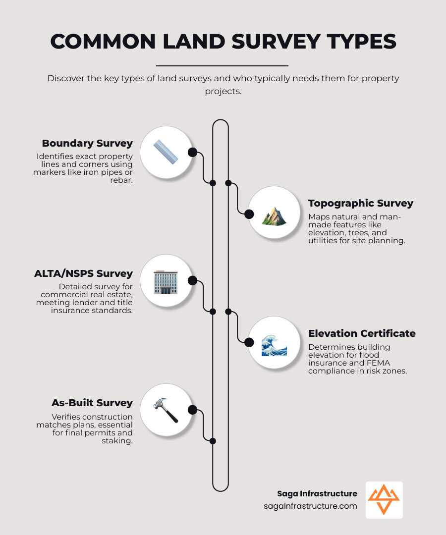
Many people skip surveys to save money. This is a mistake. It can lead to fights with neighbors or problems with the city later.
I am Don Larsen. I run Saga Infrastructure. We help land surveying companies across the country. I know how these services keep your property safe.
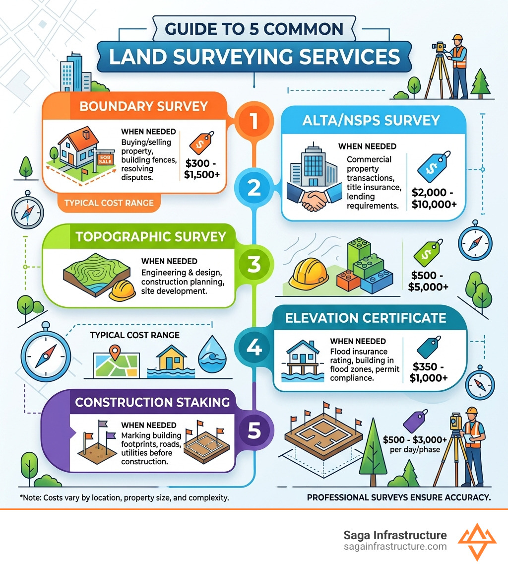
Learn more about land surveying services:
Myth 1: Fences Define Your Property Boundaries
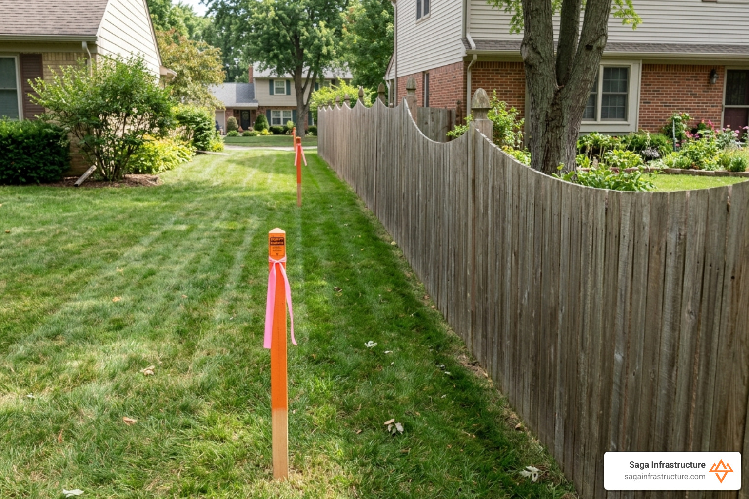
Many people think a fence shows the property line. This is often wrong. Fences are sometimes built in the wrong spot.
If you build a fence on your neighbor’s land, they can make you move it. This costs a lot of money. This is why Navigating Commercial Real Estate: A Comprehensive Guide to Surveys is helpful. It explains that property lines are legal facts, not just where a fence sits.
Why You Need a Survey for a Fence
Before you build a fence, get a survey. A professional will find the real corners of your land. They often find metal pipes buried in the ground. They will put up flags to show you where to build. This stops fights with neighbors before they start.
Solving Legal Problems
Sometimes a neighbor’s shed or driveway is on your land. A surveyor can help. They look at old records to find the truth. They can even talk in court to help you keep your land.
Myth 2: Surveys Are Only for Buying a House
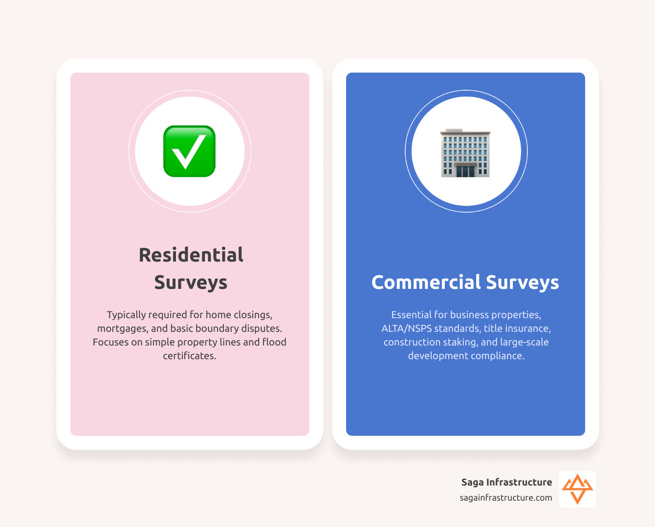
Land surveying services are used for many things. They are used to build roads, stores, and big buildings.
Detailed Surveys for Business
For big business deals, banks want an ALTA survey. This is the best kind of survey. It shows everything on the land. It shows where pipes are and what the rules are for building there.
If you work in real estate, Demystifying the ALTA Survey for Real Estate Professionals is a great guide. It helps you avoid bad surprises.
Staying Safe from Floods
In places like Florida or Texas, floods are a big deal. You might need an Elevation Certificate. This proves how high your house is. It helps you get the right insurance.
Topographic surveys are also important. They show the hills on your land. This helps builders make sure water flows away from your house. You can learn more at the Florida Department of Agriculture and Consumer Services.
Myth 3: Land Surveying Services Are Slow and Cost Too Much
Some people think a survey takes two months. At Saga Infrastructure, we know you are in a hurry. Good companies use new tools to work faster.
What Changes the Price and Speed?
- Size: A small yard is faster to measure than a huge forest.
- The Land: Flat land is easier than steep hills with lots of bushes.
- Research: If the old records are hard to find, it takes more time.
- Rush: Some firms can finish in 5 days if you pay more.
A simple survey might cost between $400 and $2,000. This is a small price to pay to make sure your expensive fence is in the right spot.
Finding a Good Surveyor
Look for a company with a lot of experience. They should give you digital maps you can use. A local company often knows the city rules better. This helps them work faster.
Myth 4: New Tech Replaces the Need for a Pro
Some people think we don’t need surveyors because we have Google Earth and GPS. This is not true. Tech helps us, but we still need a person to check the facts.
How New Tools Help
We use cool tools to be very exact:
- GPS: We use satellites to find exact spots.
- Robots: We use robot tools to measure distances.
- Drones: Drones fly over land to make 3D maps.
Why We Still Need History
A computer cannot tell you where a property line is. Property lines are legal rules. Surveyors must look at very old papers from a long time ago.
Then, they go outside to find old markers like iron pipes or stones. The “art” of surveying is matching the old papers with what is actually on the ground. A satellite cannot do that.
Frequently Asked Questions
How long does a survey take?
Most surveys take 5 to 15 days. If you are in a rush, some companies can do it faster.
When do I need a flood paper?
If you live in a place that floods, your bank will want an elevation certificate. It can also help you pay less for insurance.
How do I get a survey?
- Ask for a price: Tell the surveyor your address.
- Research: The surveyor looks at old maps and deeds.
- Field Work: A crew visits your land to measure it.
- Final Map: You get a map that shows your property.
Conclusion: Protecting Your Land
At Saga Infrastructure, we know land is important. It is your home and your future. Whether you live in Florida, Texas, or Arizona, land surveying services protect your rights.
We help local surveyors use the best tools. This keeps their work fast and exact.
Don’t let myths lead to mistakes. Protect your land with a real survey.
Start the conversation with Saga Infrastructure today to see how we can help.